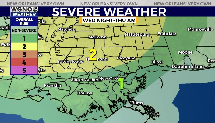
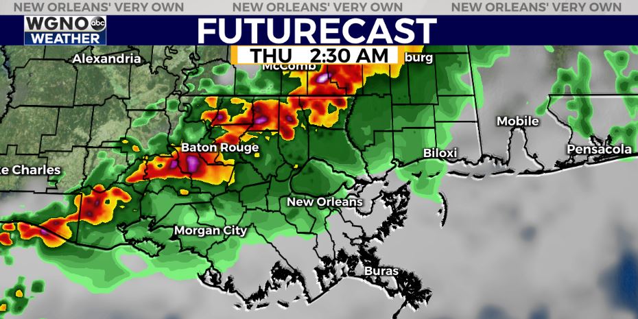
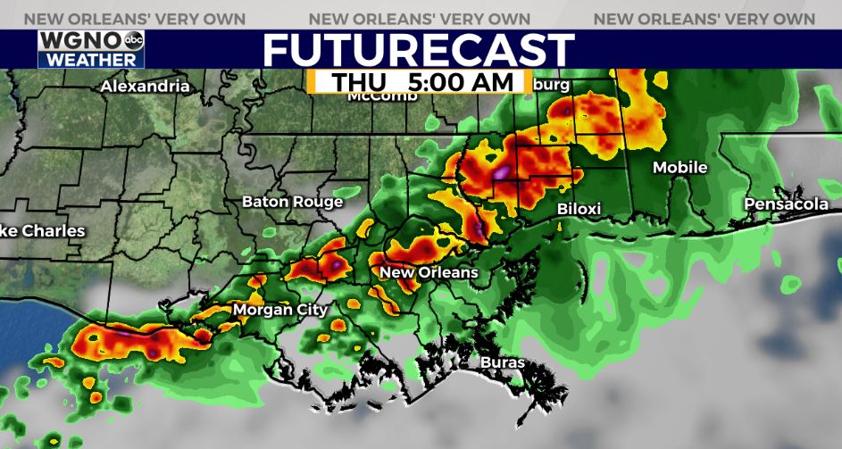
A line of storms will be moving through the area late tonight and Thursday morning. Locally heavy rain and lightning will be the main threat but there will be a chance for a few strong to severe storms.

The level 2 threat area has been extended further south. This means a little better chance of a severe storm. The most likely area though is still north of I-10.

Storms will move into the I-55 corridor around 2 AM. These will continue moving east/southeast through the early morning hours.

These storms will end by mid to late morning Thursday and we will see a break in the rain chances. However scattered showers come back Friday with another widespread threat of heavy rain by Saturday morning.


