We are still feeling the effects of our most recent cold front with temperatures staying chilly across the Southeast. Highs today stayed about 10 to 15 degrees below average across South Louisiana and the Mississippi Coast and a few more chilly days are in store for the area.
Another freeze is expected tonight as low temperatures drop into the upper 20s for the southshore and into the lower and mid 20s for locations north and west of Lake Pontchartrain.
A Hard Freeze Warning is in effect for parishes west of Lake Pontchartrain and most areas north of I-10, including South Mississippi from 11 PM Friday through 9 AM Sunday. A Hard Freeze Warning is issued when temperatures in the lower to mid 20s are expected.
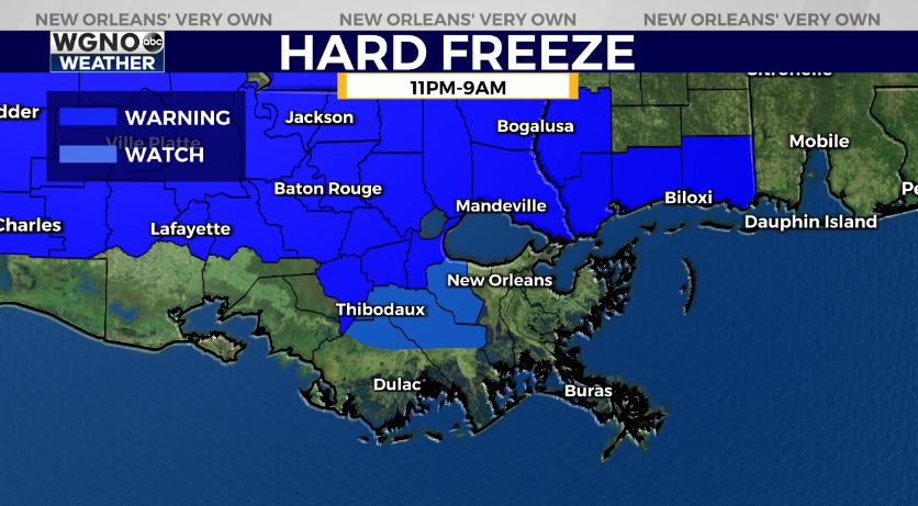
Elsewhere, south of I-10, a Freeze Warning is in effect where temperatures could drop as low as 28 degrees.
Heading into the start of the next work week, we’ll be watching for showers and possibly a few thunderstorms late Monday afternoon into Monday night. The rain comes ahead of our next front, but this one shouldn’t be as powerful as the most recent cold snap.