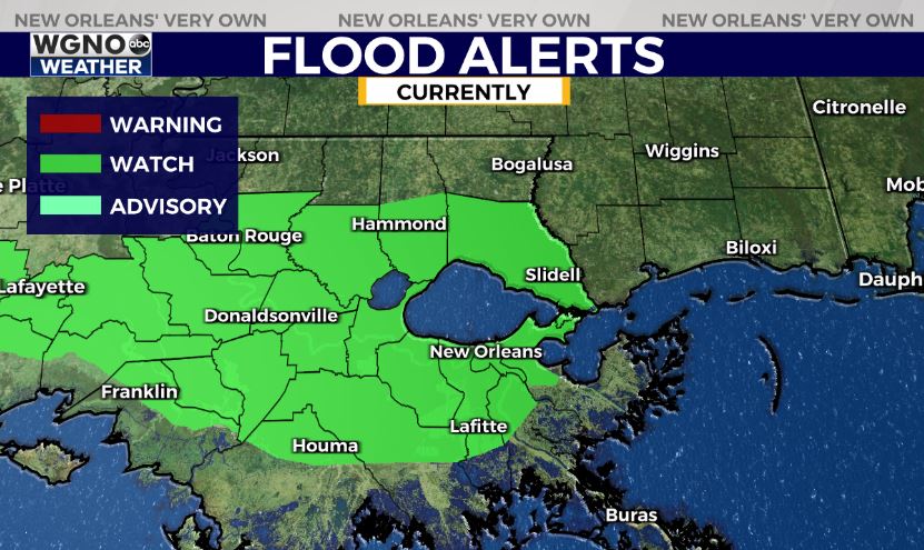
NEW ORLEANS (WGNO) — More rounds of rain and storms are likely Friday night into Saturday morning and that could lead to areas of flash flooding after heavy rain earlier Friday morning in some spots. A flood watch is in effect through Friday night for that potential. Locally heavy downpours will occur in many areas overnight.
Storms could also produce strong wing gusts and an isolated tornado threat, so the SPC does have a level one risk outlook over the area through Friday night.

Look for the first wave of storms later Friday evening into early Saturday, followed by another round through around sunrise Saturday. After that the frontal boundary will still be lingering over the area which will cause off and on showers through the day Saturday.
Things will finally clear out as the main system pushes through early Sunday, and most of Sunday is looking dry. Expect cooler conditions back in the area by early next week.
Stay up to date with the latest news, weather and sports by downloading the WGNO app on the Apple or Google Play stores and by subscribing to the WGNO newsletter.


