NEW ORLEANS (WGNO) — Fog and low cloud cover is out there again Wednesday morning so be careful driving in areas with fog before 9 AM. Like Monday though that will burn off through the day and we will see plenty of sun with warm air.
Temperatures will be warm with the mid to upper 80s and then drop mostly into the 60s tonight into Thursday morning.
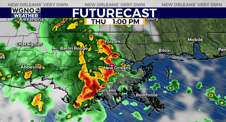
Recent model trends now put a storm cluster coming through the area on Thursday. This would be similar to what we saw on Monday with a line of heavy rain and gusty winds moving through midday with lingering showers. It’s important to note this is a recent trend that needs to be watched through the day. However be prepared to at least deal with some rain through the early afternoon Thursday.
Friday looks like hit or miss activity in terms of rain with drier weather through the weekend as temperatures heat back up to the upper 80s.
Stay up to date with the latest news, weather and sports by downloading the WGNO app on the Apple or Google Play stores and by subscribing to the WGNO newsletter.


