A cold front will be fading out over the area through the day Friday but that will help to trigger showers and storms. The overall pattern will still be similar to the past couple of afternoons where we see showers and storms fire up from the daytime heating. However with the front nearby the chance will be a bit higher in the 50% range. These probably won’t be moving much so there will be a risk of localized street flooding, especially in areas that saw heavy rain on Thursday.
By the weekend we are back to isolated coverage on Saturday and then again a bit better rain chance in the 40-50% range on Sunday. Temperatures will be hot over the next week topping out around 90 Thursday and Friday and then low 90s for the weekend into next week.

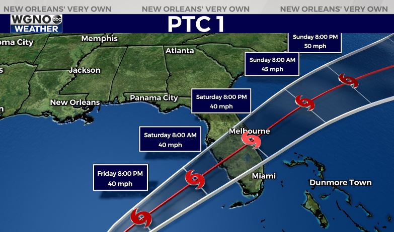
The National Hurricane Center began issuing forecasts for Potential Tropical Cyclone 1 on Thursday afternoon. This system will eventually turn into Alex, but the potential classification means it’s not yet a closed center of circulation but they still want to put out a forecast track and any watches or warnings needed.
This system will continue to move northeast off the Yucatan Peninsula. Strong wind shear will prevent it from strengthening too much but it is still expect to develop into a named storm.
This will not be an issue for the northern Gulf but will bring very heavy rain and gusty conditions across south Florida and the Florida Keys through Saturday.


