NEW ORLEANS (WGNO) — An area of low pressure will move across the northern Gulf over the next couple of days and will be strengthening as it does so. Expect rain to continue through the day on Tuesday but in a less persistent manner than on Monday. Heaviest amounts will be found south of I-10 and in southern Mississippi.
The bigger story over the next couple of days looks like it will be the wind. As the low moves east the wind will increase and be gusting into the 20s across most of the area. Some areas will see gusts in the 30s and potentially even 40s. Because of that we have a wind advisory in effect for part of the south shore.

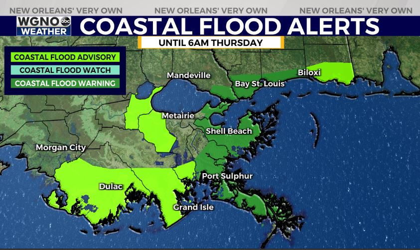
As the wind increases it will be piling water onshore from the east and northeast. The persistent onshore flow could lead to coastal flood issues. We could see levels of 2-3 feet above normal during high tide cycle in low lying areas. Some areas may even get a little higher. It may be a good idea to move any vehicles in these areas to higher ground. A coastal flood warning and advisory are in effect for parts of the area. This includes the southwestern side of Lake Pontchartrain.

Much nicer weather will move in for the second half of the week.
Stay up to date with the latest news, weather and sports by downloading the WGNO app on the Apple or Google Play stores and by subscribing to the WGNO newsletter.


