Expect a calm weather pattern over the next 48 hours with lots of sunshine in the afternoon. Highs Wednesday and Thursday (St. Patrick’s Day) look to be slightly warmer with the lower 70s tomorrow and mid to upper 70s.
Humidity levels will stay elevated through the remainder of the week, making it feel slightly warmer during the heat of the day.
Rain chances stay very low until late Thursday night into Friday morning. Our next system then may bring another round of strong to severe storms, but it is still a little too far out to pinpoint exact timing.
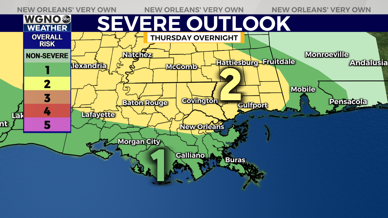
For now, the Storm Prediction Center has outlined most of the WGNO viewing area under a “Slight Risk” for severe weather, which is level 2 out of 5 on their scale. Closer to the Gulf, there is a “Marginal Risk,” which is a level 1 threat.

With any severe storms that form, the main threats will be damaging wind gusts and isolated tornadoes. Some storms may have heavy downpours, but the flood threat remains low.
Stay tuned for forecast updates from WGNO on air and online at digital-staging.wgno.com!


