Good morning and a Happy Friday coming off of storms late last night! Yesterday was our first 90 degree day in the city, and we broke the existing record high of 90, itself, at New Orleans International Airport. We’re already in the 80s as your morning continues. Southshore lows stay about 10 degrees warmer in the low to mid 70s than northshore lows all week. Expect highs to reach the upper 80s again today and this weekend.
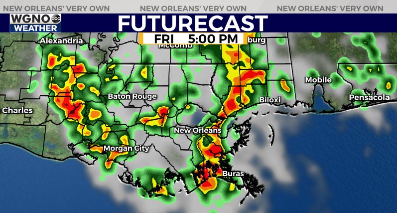
We start to see rain back in the forecast starting this afternoon and that trend will continue over the next few days. Look for warm temperatures in the upper 80s each day before that rain develops. These storms will be moving north to south around an area of low pressure to our east.
At this point it doesn’t look like we will see a washout during any one day, but by mid to late afternoon rain will be developing and moving through. Expect locally heavy downpours and lightning with the storms. There could also be a few stronger storms that produce strong wind gusts and small hail.
This pattern will continue through Saturday with coverage around 50-60% and then become a bit more hit or miss on Sunday. After that it looks like we dry out again early next week.

Look for a bit more widespread rainfall on Friday. This again looks to be in the mid to late afternoon time frame as we see rain develop and move south. Once again gusty winds will be possible with the stronger activity. That batch of rain will likely cover more of the area.
We will see another round of showers and storms develop Saturday afternoon with more hit or miss activity by Sunday. Temperatures through the weekend will top out in the mid to upper 80s before the rain moves in with overnight lows in the upper 60s to low 70s.


