As of noon on Election Day a weak cold front was draped along the I-10 corridor. Temperatures are slightly cooler north of the front by about 5-7 degrees on average. This is not a major factor in terms of big time cold air moving in. However with the front in place rain chances are going to continue the next few days.
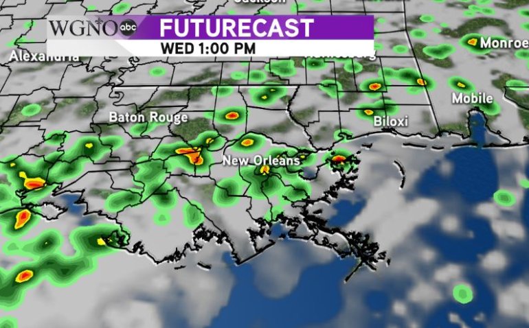
In general an unsettled pattern will remain across the lower MS River valley through Friday. As the front dissipates today, we will be left with a lot of moisture in the area. Disturbances will be pushing through over the next few days that will trigger showers each day.  The Futurecast for Wednesday shows that rain potential. While not a solid area of rain we are going to see numerous to widespread showers with locally heavy downpours for a brief time.
That activity will continue on Thursday before the main part of the system finally moves through Friday to clear things out by the weekend.
Temperatures will gradually cool down through Friday as well.


