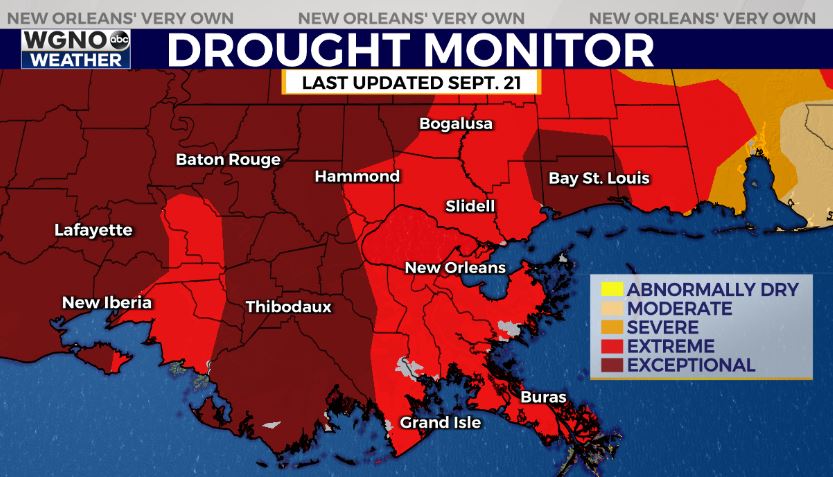
NEW ORLEANS (WGNO) — The latest drought monitor is out and it’s not good. All of southeast Louisiana and southern Mississippi is in either the extreme or exceptional category. Unfortunately it will likely to get worse with no real shot of rain any time soon. Please conserve water and remember to follow the burn ban that is in place.
Afternoon temperatures will continue to top out in the 89-92 range over the next few days.
High pressure building across the area will provide generally calm conditions for the next week with little to no rain in the forecast.
In the tropics, the National Hurricane Center is tracking Hurricane Nigel in the Central Atlantic, which is forecast to remain over open water. The NHC is also watching a tropical wave near Africa that has a 70 percent chance of formation over the next week as it moves west across the Atlantic.
We could also see development near the southeast coast this weekend and next week. This looks like something that would either move up the east coast or just inland in North Carolina. This will not be something that impacts the Gulf coast.
Stay up to date with the latest news, weather and sports by downloading the WGNO app on the Apple or Google Play stores and by subscribing to the WGNO newsletter.