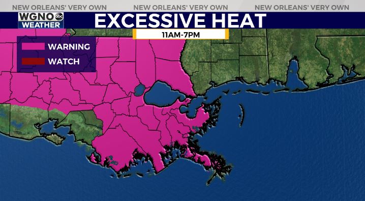
Good Morning, New Orleans! A much hotter weekend is coming! While a washout is not anticipated on any given day, rain chances will be around 50 percent through your afternoon. Most models show fairly dry mornings with storms developing in the early afternoon, some of which could be severe.
Any storms that develop may produce frequent lightning and thunder, locally heavy downpours, and gusty winds. Most rain will come to an end shortly after sunset as we lose daytime heating that fuels the afternoon storms. The Storm Prediction Center is issuing a Slight Risk east and Marginal Risk farther southwest for severe weather in parts of the viewing area.
Temperatures are expected to warm into the low and possibly even mid 90s with consistent sunshine in the forecast. Heat index values or “feels like temperatures” will reach the triple digits (~113+ degrees). A Heat Advisory is issued for those not under Excessive Heat Warnings.

Highs through Friday afternoon will generally range from 94-98 and of course it will get cooler if any storms pop up nearby.
In the tropics, the National Hurricane Center is highlighting an unorganized disturbance just off of Africa’s coast with moderate development potential. It’s certainly early in the season to be seeing this, so we’ll keep watching the system closely.


