NEW ORLEANS – A Hurricane Watch is in effect for our viewing area with the potential of hurricane conditions over the next 48 hours.
This could be upgraded to a warning by this evening.
Right now, it looks like overnight Saturday night will be the timing of the most significant impacts from Nate.
Most of the area will see tropical storm force winds with gusts to hurricane force.

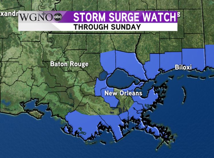
We have a Storm Surge Watch for part of the area as well. This is a new product from the National Hurricane Center issued for the potential of surge three feet or higher.
This is for areas outside the levee system.
We will continue to see water increase in areas that already have minor flooding this week.
If you are in an area that floods easily, you should move to higher ground.

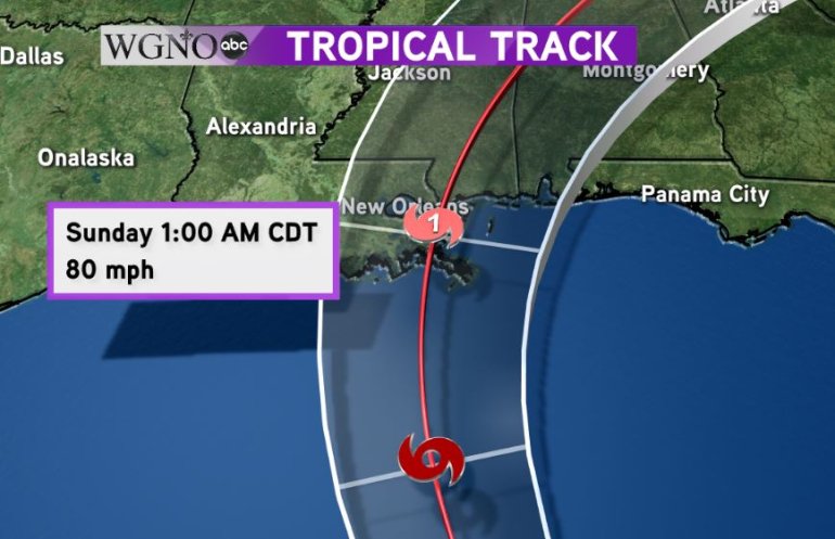
The current forecast brings Nate into southeast Louisiana as a minimal category one storm.
There are still some questions about the eventual strength of the system, and either a stronger or a weaker storm is still possible. Also, a small shift to the east is possible as well through the next day or so, which would lessen the overall impacts.
Right now, you need to prepare for tropical storm conditions.
Storm surge flooding and high wind will be the main issues. The storm is moving so fast that we will likely not see tremendously high rainfall amounts.
Winds could be strong enough to produce damage and knock out power, especially east of the landfall point.
Stay with WGNO on-air and online for the latest.

