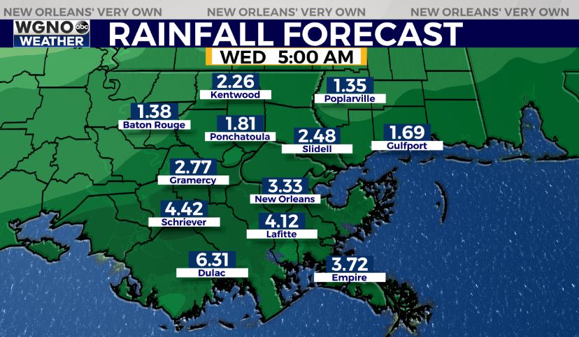
NEW ORLEANS (WGNO) — An area of low pressure will move across the northern Gulf over the next couple of days bringing much needed rain to our area. This low now looks to stay farther offshore which will keep the severe weather and flooding threat away as well. So this will be exactly what we need with a solid two days of rain. This will strengthen as it moves across our region though and winds will be on the increase.
Expect rain to spread across the area through the morning Monday and continue for the most part through late on Tuesday. Rain will shift east by Wednesday.

Overall amounts will be in the 2-4 inch range for most of the area. Lower amounts will be north of I-12 with higher amounts possible near the coast.
Wind will also pick up as this low moves across the area. Most of the wind will be out of the east and northeast.
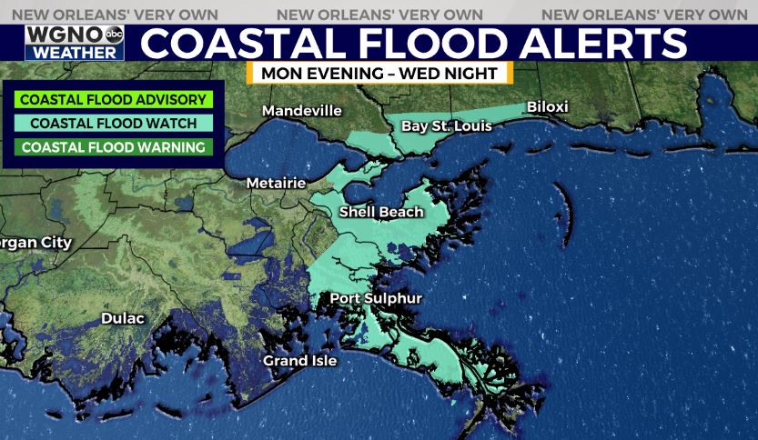
Strongest wind gusts will be near the coast but most of the area will see gusts in the 20s and potentially 30s as well. The persistent onshore flow could lead to coastal flood issues.

We could see levels of 2-3 feet above normal during high tide cycle in low lying areas. It may be a good idea to move any vehicles in these areas to higher ground.
Much nicer weather will move in for the second half of the week.
Stay up to date with the latest news, weather and sports by downloading the WGNO app on the Apple or Google Play stores and by subscribing to the WGNO newsletter.


