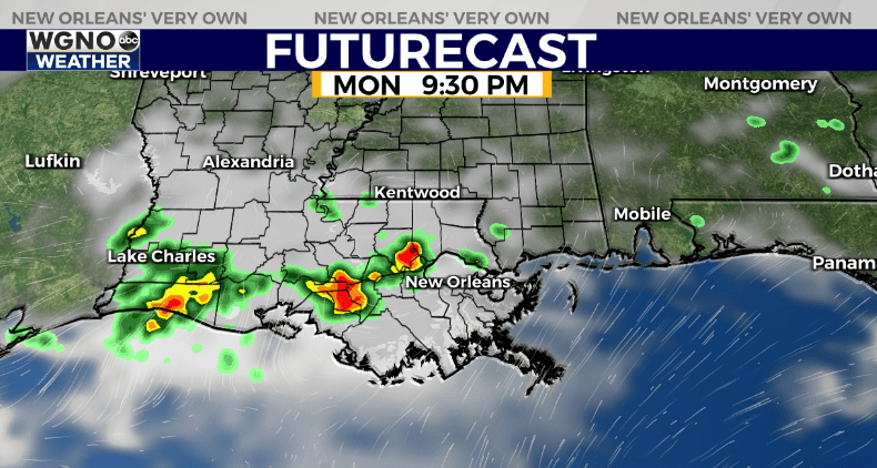
NEW ORLEANS (WGNO) — This round of heat and humidity will likely peak on Monday and we have a heat advisory for part of the area because of it. Most of us will not reach the heat index level which is normally required for these. However due to so many people being outside through the day and the fact that this will likely be the hottest day this year so far the Weather Service went ahead and issued the advisory.
After that look for highs around 90 again on Tuesday with upper 80s more common through the rest of the week. We start to shift the pattern a little bit where the area is under a bit more of a northwest flow. That tends to knock temperatures down a little.
That also means we could start to see rain chances come back. Right now it’s one of those patterns where it is very tough to time out individual areas of storms more than a day out. We could also see a few daytime heating storms develop each afternoon.

We could see our first round of storms later in the day on Monday. This likely won’t be for the entire area, and that trend continues on Tuesday or Wednesday. Strong wind gusts could occur with any stronger storm.
Stay up to date with the latest news, weather and sports by downloading the WGNO app on the Apple or Google Play stores and by subscribing to the WGNO newsletter.


