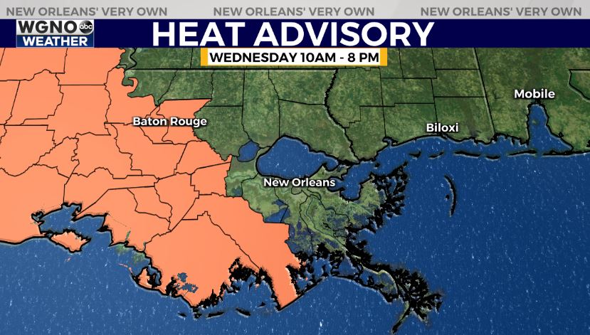
NEW ORLEANS (WGNO) — A heat advisory is now in effect for the western side of the area on Wednesday. These are areas that are likely to see less rain, or at least later developing rain, through the day. Expect temperatures in the mid 90s with heat index values 108 or above. Stay hydrated and take it easy in the heat.
Storms will continue moving southeast offshore this evening and rain chances will be low through the rest of the night.
Scattered showers and thunderstorms will continue to be the theme with the weather forecast for the next couple of days.
While no single day will be a complete washout, rain chances are elevated at 60 to 70 percent to account for off and on storms through Wednesday. Some storms may produce frequent lightning and gusty winds.
Portions of Southeast Louisiana and South Mississippi are under a “Marginal Risk” for flash flooding on Tuesday and Wednesday, which is threat level 1 out of 4 on the Weather Prediction Center’s excessive rainfall scale.
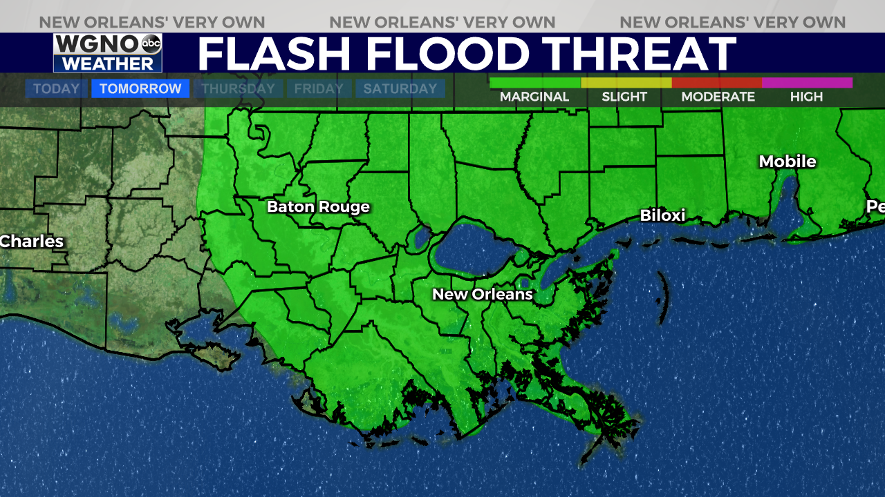
Locally heavy downpours will be possible and rainfall may accumulate quickly with any slow-moving storms that develop.
Rain chances are forecast to drop down to around 30 percent by the second half of the week as high temperatures gradually climb back into the mid 90s.
In the tropics, the National Hurricane Center is monitoring one disturbance in the northern Atlantic that has a medium chance for formation. However, this system is expected to remain over open water and poses no threat to land.
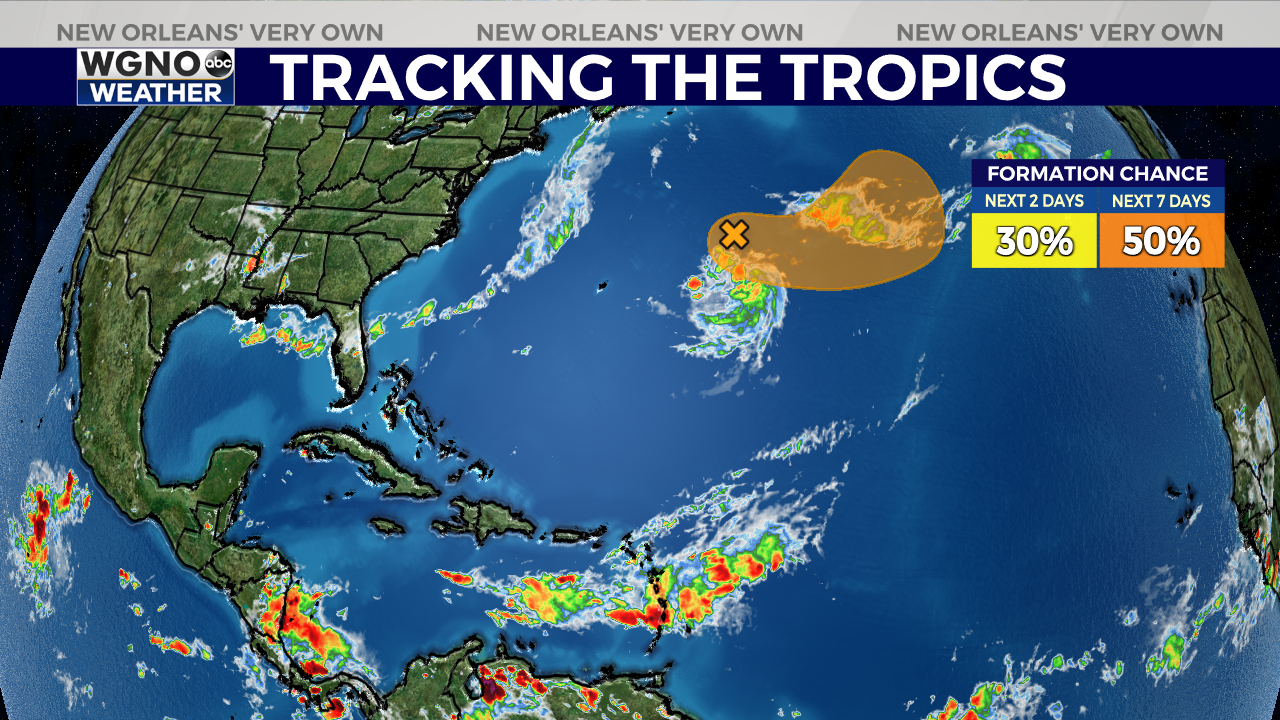
Otherwise, the NHC is not expecting any development over the next seven days. Large plumes of Saharan dust moving across the Atlantic should help keep tropical formation chances low through at least the next couple of weeks.
Stay updated with the latest news, weather, and sports by downloading the WGNO app on the Apple or Google Play store and subscribing to the WGNO newsletter.