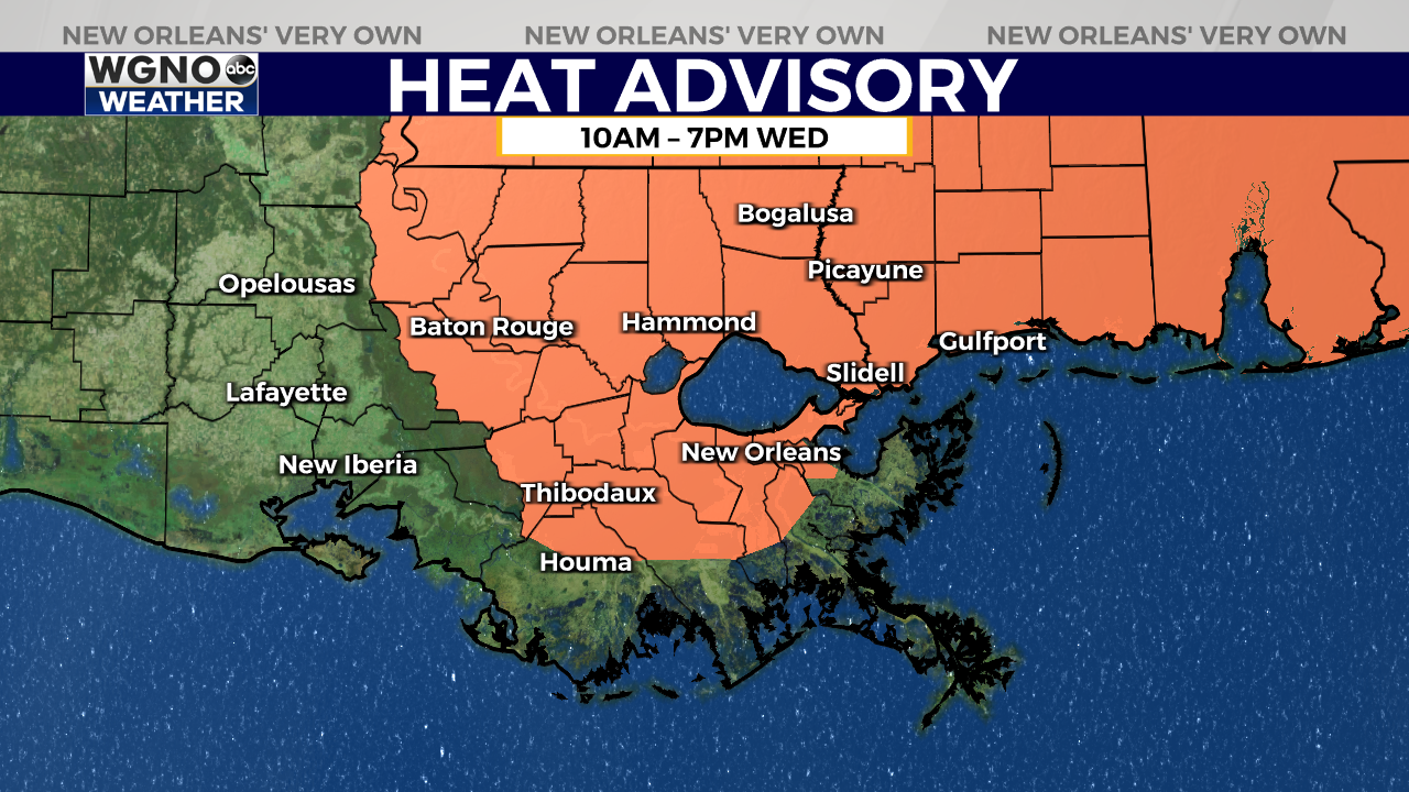
NEW ORLEANS (WGNO) — The National Weather Service in New Orleans has issued a Heat Advisory for much of the area, excluding locations along the immediate Louisiana coast, from 10 a.m. to 7 p.m. Wednesday.
Temperatures are forecast to warm into the mid-90s, with heat index values expected to reach between 108 and 112 degrees.
Overnight lows will hover around 80 degrees, which means the heat will persist into the next day, increasing the risk of heat-related illnesses. The heat stress is expected to be more severe in urban areas where temperatures tend to remain higher for longer periods.
Scattered showers and thunderstorms are likely, especially in the afternoons and early evenings, but the chances of rain will increase significantly starting Thursday and continuing into the weekend.
A low pressure system will slowly move eastward, bringing more moisture and instability to the region. This will lead to a greater likelihood of rain, particularly in the northern parts of the area.
As the system moves into the Gulf and interacts with a front near the coast, rain coverage will remain high through the weekend and into early next week. Storms are expected to be slow-moving, which increases the risk of localized flooding. While severe storms are not anticipated, heavy rain and potential flash flooding will be the main concerns. Waterspouts could form over Lake Pontchartrain and just offshore with some of these storms.
Despite the increase in rainfall, overnight lows will not see much change, staying around 80 degrees. High temperatures will drop into the upper 80s by the weekend due to the enhanced cloud cover and rain.
Stay up to date with the latest news, weather and sports by downloading the WGNO app on the Apple or Google Play stores and by subscribing to the WGNO newsletter.