Several flash flood warnings (maroon) and flood advisories (green) are in effect Thursday afternoon as the line of heavy storms continues to move east. This line is a little weaker than it was earlier in the day but the slow movement will continue to mean that street flooding will be possible, especially in areas of southern Mississippi this afternoon.
A tornado watch is still in effect for the southern Mississippi counties as well but the overall threat should be diminishing. Otherwise we will wait for colder air to filter in behind the front.

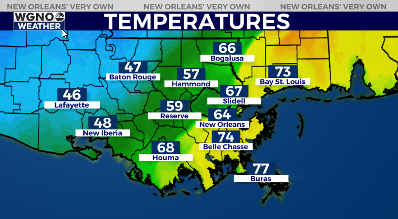
Temperatures are dropping quickly behind the front and we will see much colder weather heading into tonight and through the next couple of days. Look for highs only in the mid 40s on Friday.
Expect windy conditions overnight behind the front as well with showers redeveloping through the first half of the day Friday.


