Simply a winter day today across southeast Louisiana and New Orleans proper after Tuesday’s front cleared our area, ending storms, thunderstorms, plus overnight low-end severe threats!
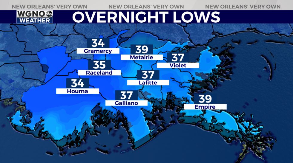
Earlier, forecasts verified since we were anticipating an incredibly windy, chilling start with 40 degree temperatures beyond Lake Pontchartrain.
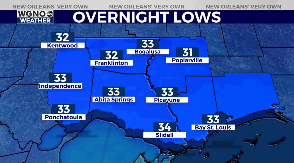
Thursday, lows drop even more to be below 33 degrees as December continues. Brace yourself: I am talking coldest weather throughout your region on maps across Southshore locations since pre-COVID times circa February!
Freeze Warnings fly across Gulf Coast coastlines from Texas – Western Louisiana based off of frigid overnight lows ranging between 28 & 32 degrees! This is issued nowhere across Northshore locations but frost remains possible. Remember all 3 Ps: people, pets, plants! Fortunately, for these next 48 hours, pipes won’t face any problems!
Keep up, updates stay available during Good Morning New Orleans plus online!
Check out current conditions near you: https://digital-staging.wgno.com/weather/new-orleans-weather-radar/
Stay up to date with the latest forecast: digital-staging.wgno.com/weather/forecast/
Download the WGNO Weather App to stay connected this hurricane season