A lot of talk has been going around about the potential for snow in the area late Monday night and Tuesday morning. Most of southeast Louisiana and southern Mississippi will not be seeing anything significant. However if cold air arrives soon enough we could see a little bit of wintry precipitation in the area.
This is an unusual setup for winter weather in the south. Most of the time snow or ice occurs with cold air already in place and moisture moving in over top of that. This time around we have a cold front moving into the area with some rain lingering behind the front. If temperatures can cool quick enough before the precipitation ends the chance exists for a little snow or sleet.
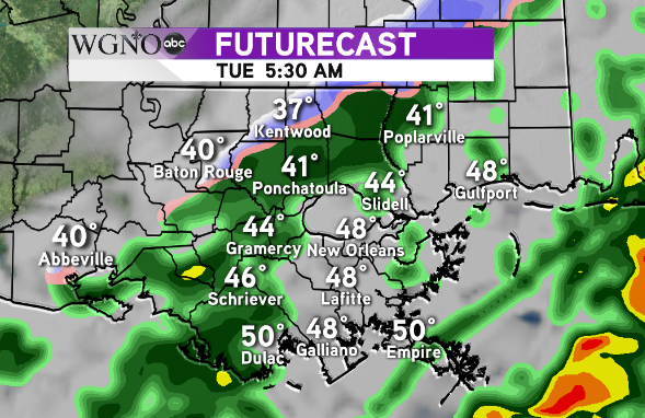
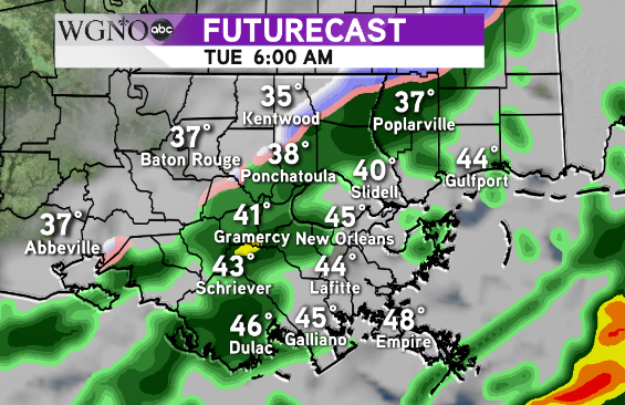
The best chance for this will be north of I-12 in LA and I-10 in MS.  At 5:30 Tuesday morning the Futurecast shows a thin band of snow and ice on the northern side of the rainfall. This occurs as the cold air behind the front moves in.
  This band continues to move east and south over the next couple of hours with the cold air. Notice in both model images the temperatures stay above freezing. Due to the short time-frame of wintry weather and temperatures above freezing we are not expecting any issues on the roads. A light dusting of snow in the coldest spots on cars and roof tops will not be out of the question.
An earlier arrival of the cold air would mean a better accumulation potential, while any slowing of the cold will mean all rain in the area.
As always stay with WGNO through the day Monday and Tuesday morning for the latest updates.


