NEW ORLEANS (WGNO) — Beryl has finally been downgraded to a Tropical Depression. Good riddance.

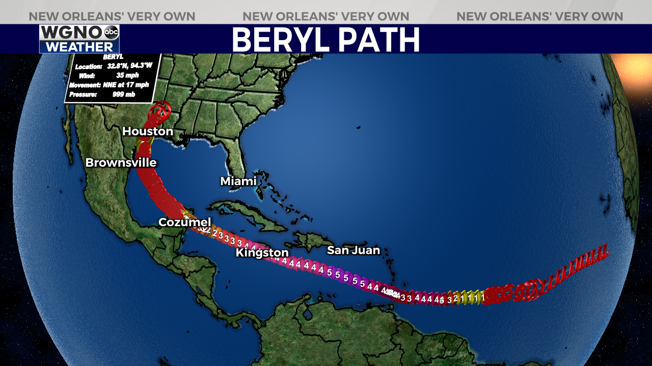
31 hurricane hunter missions in, & around, historic Hurricane #Beryl from June 30th to July 8th, 2024. 3(nearly 4) life-time landfalls in the Windward Islands, near-pass to Jamaica, Yucatan of Mexico & Texas.

Beryl became the earliest forming category 5 hurricane on record in the Atlantic basin. It also became the strongest Atlantic hurricane on record in July with 165 mph winds.
This storm intensified right up until landfall, which brought widespread 60-80+mph winds across the Houston Metro Area leaving over 2.5 million customers without power.

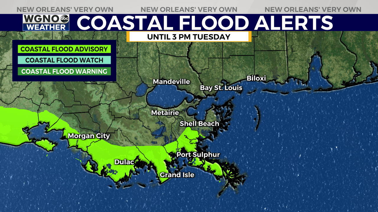
For coastal south Louisiana, with persistent onshore winds 15-30mph, a coastal flood advisory remains in effect through high tide tomorrow mid day to early afternoon. Tidal rise around a foot likely.

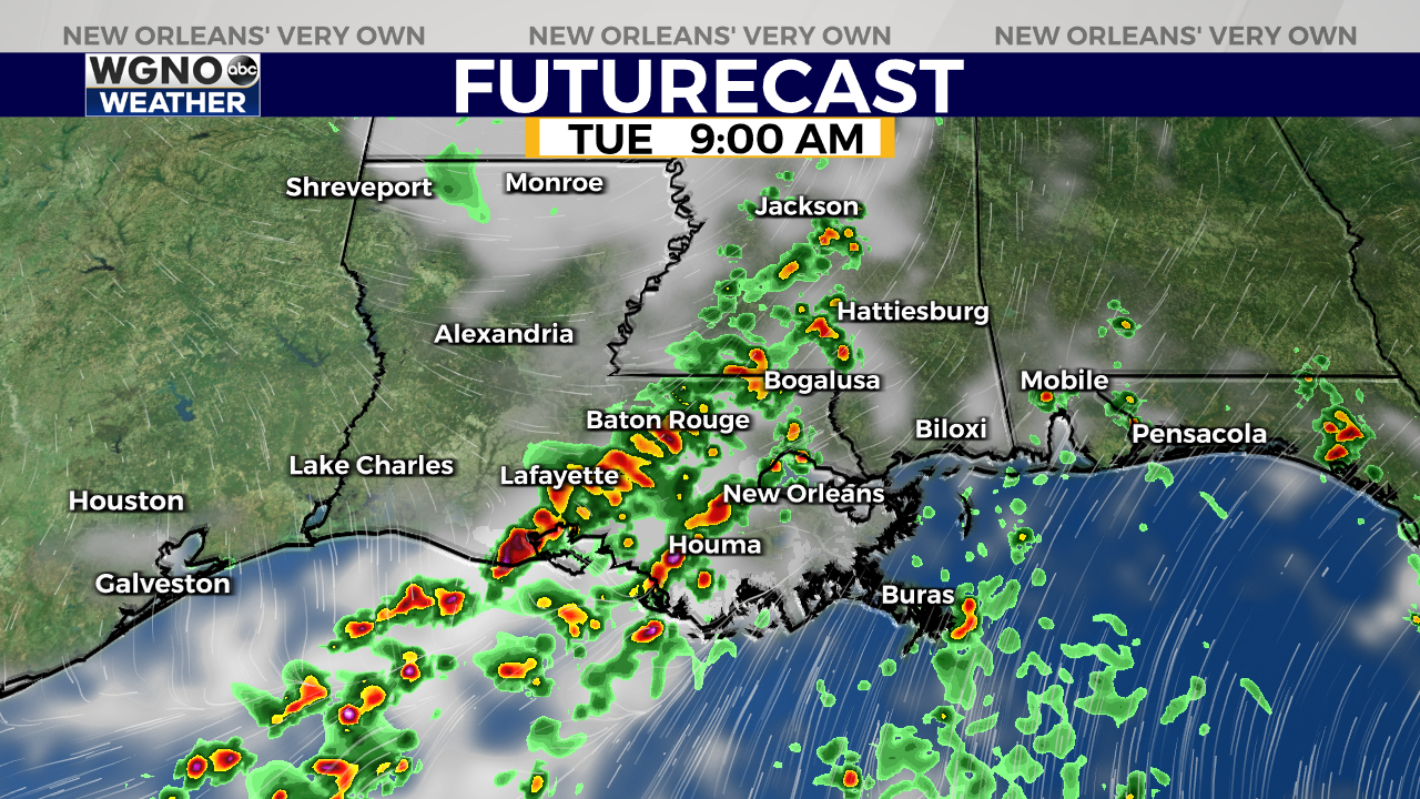
High-res model guidance highlighting higher rain chances overnight-Tuesday across southeast Louisiana. It won’t rain all day, but I’d expect to dodge off & on storms.
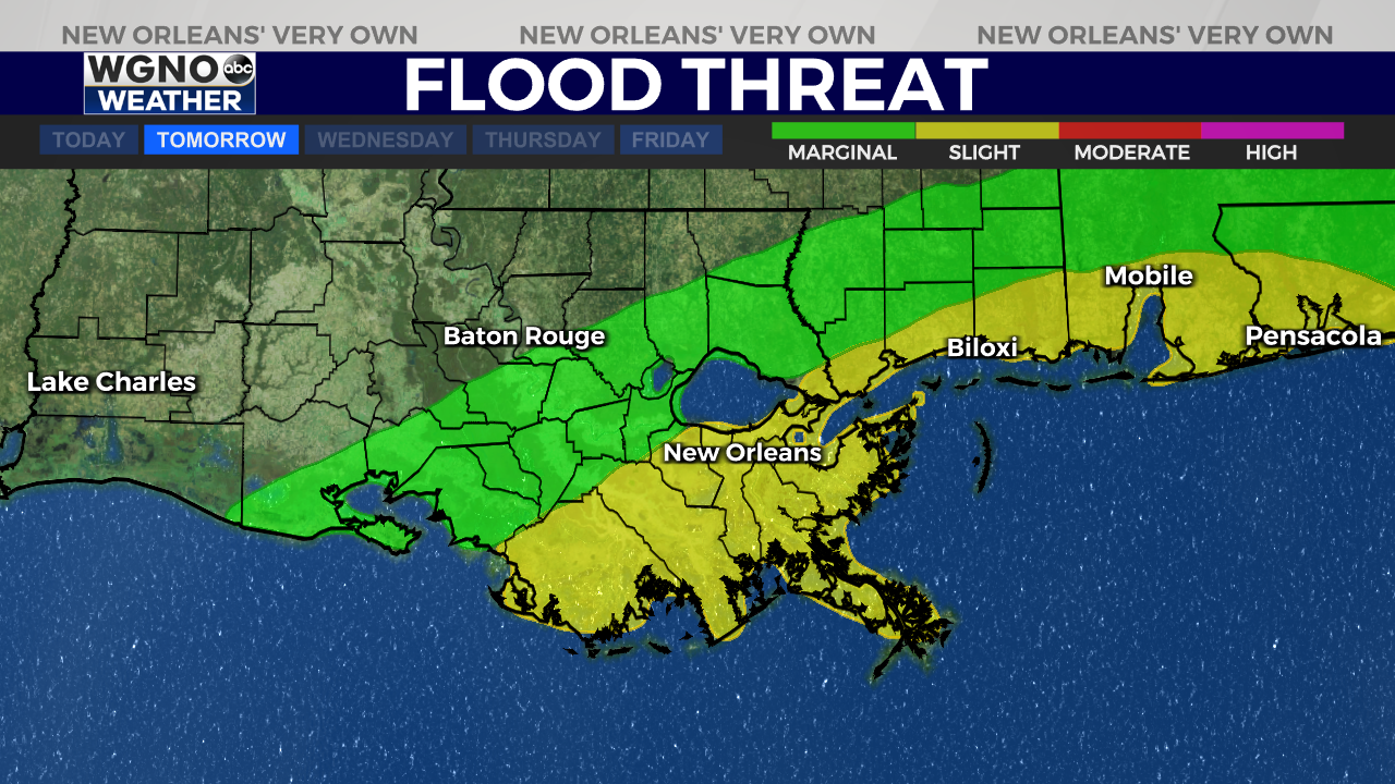
Weather Prediction Center has placed a Slight Risk(Level 2 out of 4) for excessive rainfall & flash flooding. Watch for storms to produce quick 1-3″ of rainfall.

Weather Prediction Center has placed a Slight Risk(Level 2 out of 4) for excessive rainfall & flash flooding. Watch for storms to produce quick 1-3″ of rainfall tomorrow.
Stay up to date with the latest news, weather and sports by downloading the WGNO app on the Apple or Google Play stores and by subscribing to the WGNO newsletter.


