NEW ORLEANS (WGNO) — More wet weather is on the way with widespread showers and thunderstorms stretching across the Gulf Coast.

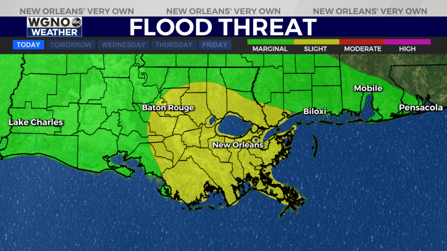
There is a Level 2 threat of excessive rainfall mainly for areas south of I-12 this afternoon and Tuesday. Ponding of water is possible in low lying and poor drainage areas. Rainfall totals of 2 to 4 inches is expected with this system this afternoon through Tuesday evening, with some isolated higher amounts of 6 inches possible. This could lead to localized flash flooding especially in urban areas.
Severe storms are also possible this afternoon through Tuesday afternoon. Damaging wind gusts and large hail are the primary threats, but an isolated tornado cannot be ruled out.
Fog could continue to be an issue through Thursday morning. A frontal system will cause a general increase in shower and thunderstorm coverage as the end of the week approaches, but where the heaviest rain sets up with this front will be in question for several more days.
Stay up to date with the latest news, weather and sports by downloading the WGNO app on the Apple or Google Play stores and by subscribing to the WGNO newsletter.


