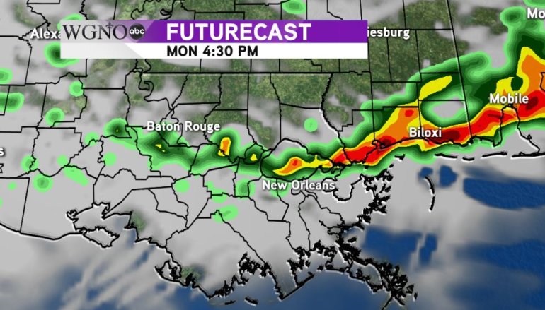
Scattered showers were already found around the area Monday morning with most of the activity still north into central Mississippi. As that system sink to the south we have the chance to see more rain develop through the afternoon.
The best chance of heavier activity will be on the north shore and in southern MS. Right now it looks like a small chance for severe weather, but the threat of a strong wind gust or some small hail will be there. In general the heavy rain would be the main issue from all of this.
 The futurecast shows a band of heavier rain working south later this afternoon. It actually looks like this activity fades out pretty quick after about 6-7 PM.
The theme for today is be prepared to dodge some rain. It won’t be an all day thing, especially on the south shore, with most of the rain setting up in the metro New Orleans area for mid afternoon.
At this point as we head into the parade time this evening a lot of this activity will be ending. As always if you hear thunder the safest thing to do is get indoors.
Mardi Gras will be warm and nice with low 80s

