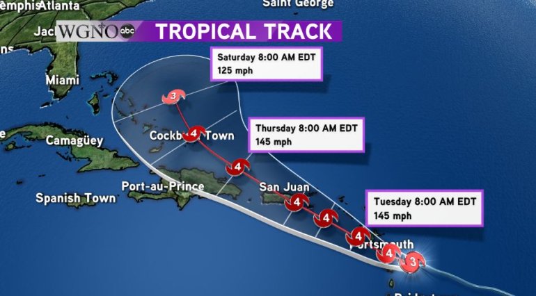
NEW ORLEANS – Hurricane Maria continued its rapid intensification overnight as maximum sustained winds reached 110 mph on Monday morning. Maria is expected to reach category four status later today.
Maria is now the fourth major hurricane of the 2017 Atlantic Hurricane Season and this marks the first time since 2010 that we’ve had four major hurricanes by this point in the season (September 18). Harvey, Irma and Jose all attained at least category four strength and it appears that Maria will follow suit.
Maria is currently moving west-northwest at 10 mph and will roar through the Leeward Islands this afternoon bringing catastrophic damage to those islands near the center of the storm. The islands that have already been battered twice by Irma and Jose are on the northern edge of the system and won’t take the brunt of this particular hurricane.
Beyond the Leeward Islands, Maria will continue moving to the west-northwest and is forecast to make landfall in Puerto Rico as a category four hurricane on Wednesday before making its way to the Turks and Caicos. After that, models are indicating that the high pressure system steering Maria will weaken and cause a turn to the north into the Atlantic before reaching the Bahamas or U.S. mainland. As this is still a week away, changes in the forecast path are possible.

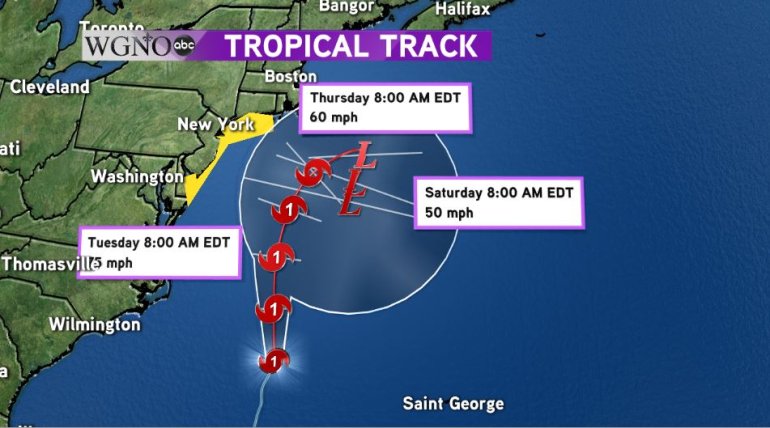
Meanwhile farther north in the Atlantic of the eastern coast of the U.S., Hurricane Jose continues its march forward. Jose is starting to lose its tropical characteristics but winds remain hurricane strength at this time. While Jose is not forecast to make landfall in the United States, due to its large size, dangerous surf and rip currents are likely for the Atlantic coast and a tropical storm watch has been issued from Delaware to Massachusetts. Jose should lose all tropical characteristics by the end of the week.

