Showers and thunderstorms will continue to pop up across the area as we head through Tuesday afternoon and over the next few days.
Some localized heavy downpours can be expected around the peak of daytime heating, mainly between 1 p.m. and 5 p.m. The best chance for rain will be along and south of the I-10 corridor.
There’s a better chance for widespread rain on Thursday and Friday, as tropical moisture from the Gulf of Mexico flows into the area. Over the next five days, around 2 to 5 inches of rain can be expected, which may lead to minor flooding in some locations.
With strong onshore wind flow, there is also the potential for coastal inundation of 1 to 2 feet at high tide. through the middle of the week. A Coastal Flood Advisory is in effect from Tuesday morning through Thursday afternoon.

Temperatures may briefly cool down where there is rain, but otherwise expect warm temperatures and high humidity to stick around. High temperatures will top out in the upper 80s prior to any rain, before cooling into the lower 80s during the evening hours. Overnight lows will be in the mid to upper 70s.
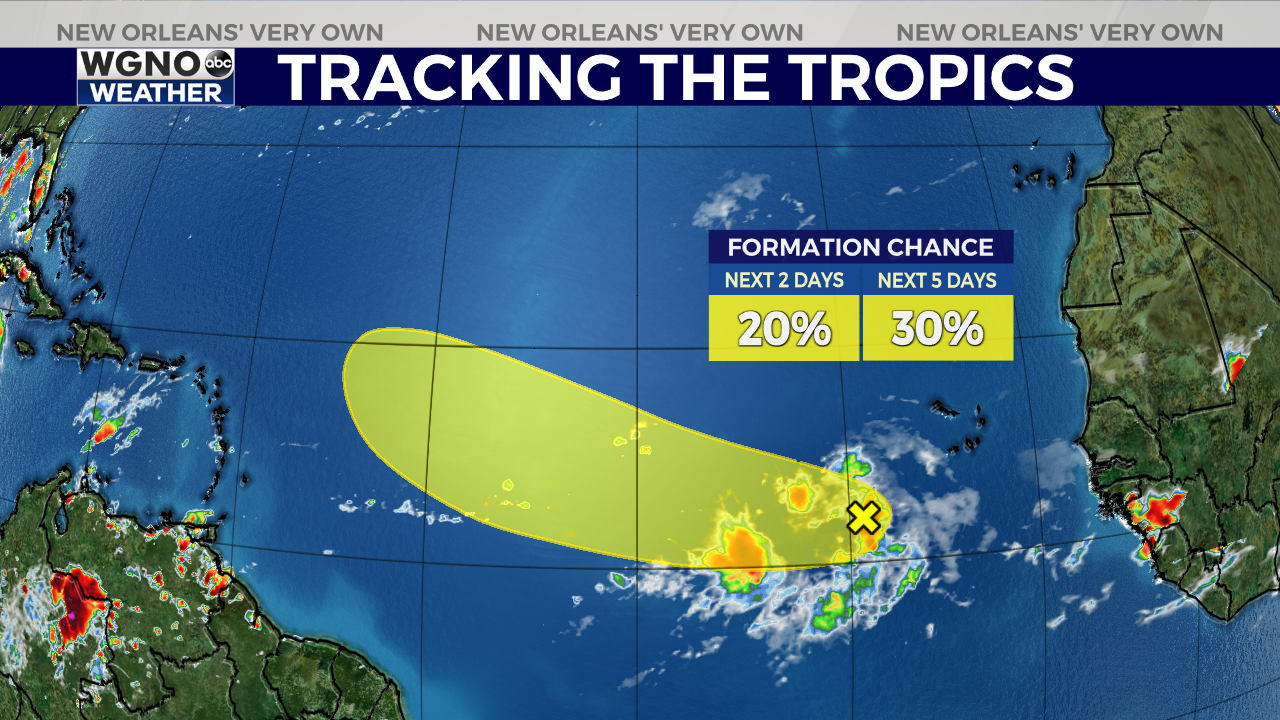
In the tropics, we are watching a tropical wave in the Atlantic Ocean, near the coast of Africa. The NHC gives the system a 30 percent chance of formation over the next five days.

Some models show the wave gradually organizing and strengthening over the next few days, while others show it dissipating due to dry air and wind shear.
Beyond a few days out, it is still too early to tell where this system will go or how it will evolve. This tropical wave is still about 3,000 miles away from the United States, so there is plenty of time to watch how it develops. If it does become a named storm, the next name on the list is Danielle.


