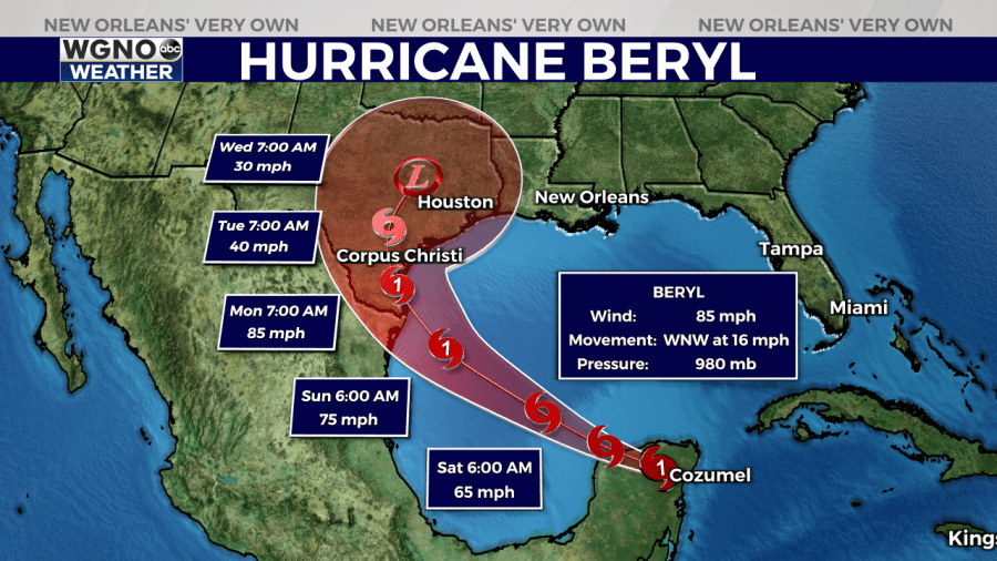
NEW ORLEANS (WGNO) — Hurricane Beryl made landfall on the Yucatan Peninsula of Mexico near Tulum earlier today. The storm’s intensity decreased as it moved inland and it is now a Category 1 hurricane.
Path and Predictions
As Beryl moves over land, it will continue to weaken, emerging over the Gulf of Mexico as a tropical storm. It may take 12-24 hours for the storm to reorganize over the Gulf before it can start to intensify again.

The forecast suggests gradual strengthening after 24 hours, likely reaching hurricane strength before making another landfall. If the westerly shear decreases as expected, Beryl could strengthen more than currently forecast.
Beryl is currently being steered by a high-pressure ridge over the southeastern United States. Over the next 24 hours, the storm is expected to turn northwest as it approaches a break in the ridge.
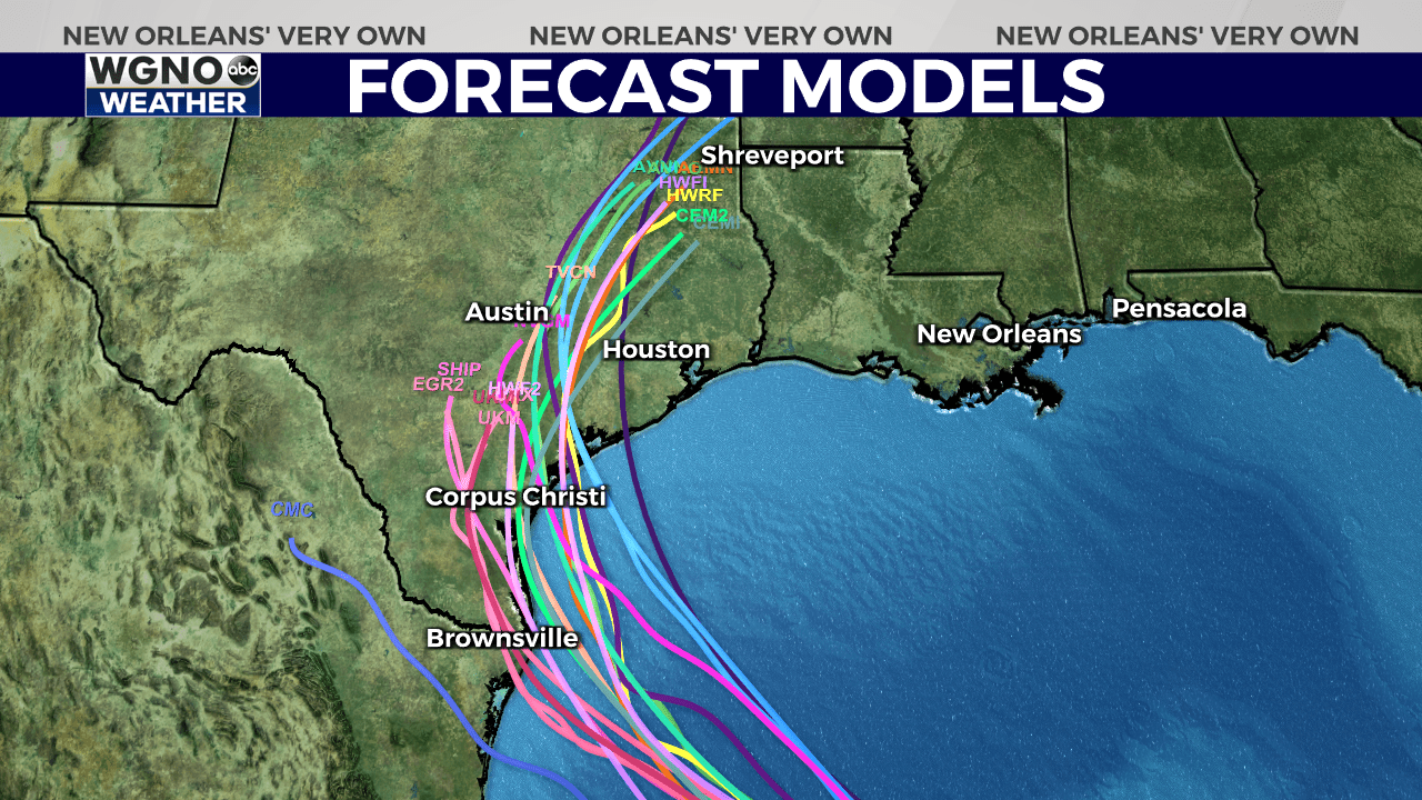
This motion should bring Beryl near the western Gulf Coast in about three days, followed by a likely northward turn.

Intensity and Warnings
As Beryl moves over land, it will continue to weaken, emerging over the Gulf of Mexico as a tropical storm. It may take 12-24 hours for the storm to reorganize over the Gulf before it can start to intensify again.
The forecast suggests gradual strengthening after 24 hours, potentially reaching hurricane strength before making another landfall. If the westerly shear decreases as expected, Beryl could strengthen more than currently forecast.
Potential Impacts and Safety
Northeastern Mexico and Texas: There is an increasing risk of hurricane-force winds, life-threatening storm surge, and flooding from heavy rainfall in parts of northeastern Mexico and the lower and middle Texas coast late Sunday and Monday. Residents in these areas should closely monitor updates to the forecast. Hurricane, Tropical Storm, and Storm Surge Watches will likely be issued later today for northeastern Mexico and southern Texas.
Gulf Coast Beaches: Rip currents will cause life-threatening beach conditions starting late today and continuing through the weekend across much of the Gulf Coast. Beachgoers should heed warning flags and the advice of lifeguards and local officials before entering the water.
Residents in the path of Hurricane Beryl are urged to take all necessary precautions to protect themselves and their property. Stay informed with a trusted source for weather updates, and follow any evacuation orders or safety advice from local authorities. The average forecast error for day 3 is around 100 miles, so it’s crucial to remain vigilant as the situation develops.
Stay up to date with the latest news, weather and sports by downloading the WGNO app on the Apple or Google Play stores and by subscribing to the WGNO newsletter.


