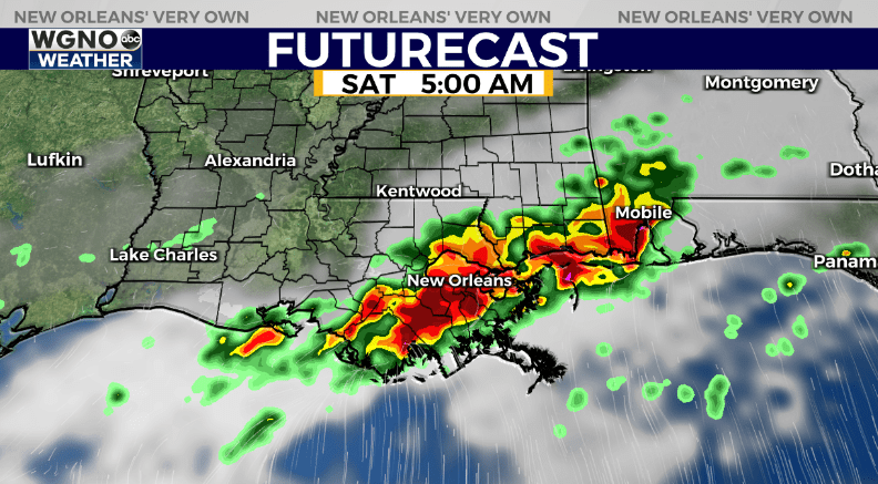
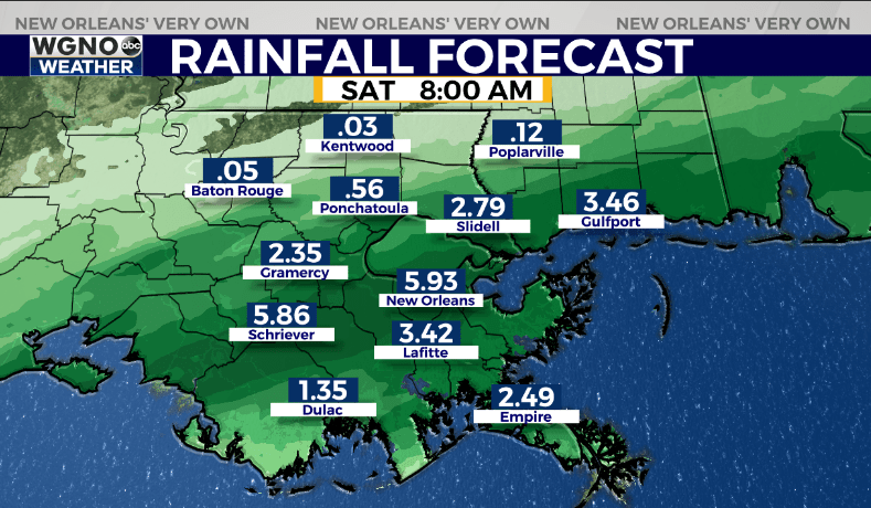
NEW ORLEANS (WGNO) — The last batch of rain and storms before we dry out will be moving into the area tonight and early Saturday morning. Once again we will have the threat of gusty winds and an isolated tornado. However it does not look like we would see wind gusts as strong and widespread as Thursday night.

At this point the bigger impact looks like it might be flooding. This area of storms will be more horizontal in formation as it moves in, and will likely last longer. This could lead to several inches of rain in the 2-7 AM time frame Saturday morning, especially south of I-12.

Storms move out by midday Saturday and we will see drier conditions over the next several days. Look for hot weather to come back with highs in the upper 80s to around 90 Sunday through at least the middle of the week.
Stay up to date with the latest news, weather and sports by downloading the WGNO app on the Apple or Google Play stores and by subscribing to the WGNO newsletter.


