Increasing heat and humidity will be the main story locally for the next few days. Tropical moisture from the Gulf continues to flow into the region as high temperatures gradually climb higher each afternoon.
High temperatures through Friday will be in the upper 80s to 90 itself, before hitting the low 90s beginning tomorrow. The low to mid 90s will stick around through the upcoming weekend. When you factor in the humidity, expect afternoon heat index values or “feels like temperatures” to be about 5 to 10 degrees warmer than what the thermometer is showing.
There is a greater chance that rain will help cool things down today than any other. We have a 30 to 40 percent chance for rain to account for pop up showers and a few thunderstorms late in the day. Any storms that develop will be brief, but may have locally heavy rainfall.
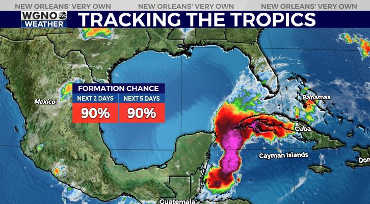
In the tropics, the National Hurricane Center is keeping an eye on the southwestern Gulf of Mexico. Hurricane Agatha made landfall on the Mexico’s southern Pacific Coast on Monday. Now, the storm’s remnants will reform into a tropical depression or storm later today in the Gulf or Caribbean.

The NHC is giving this system a 90% chance of development over the next 2-5 days.

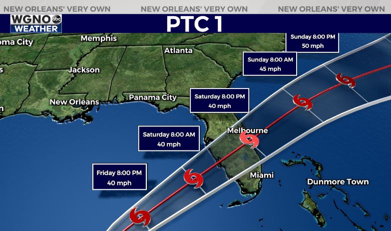
The good news is that high pressure is expected to form over the northern Gulf Coast, which will help steer Potential Tropical Cyclone One to the east toward the Caribbean before it impacts Florida’s southern most tip. If it becomes a named storm while over the Gulf or Caribbean, it would get a new name: Alex.


