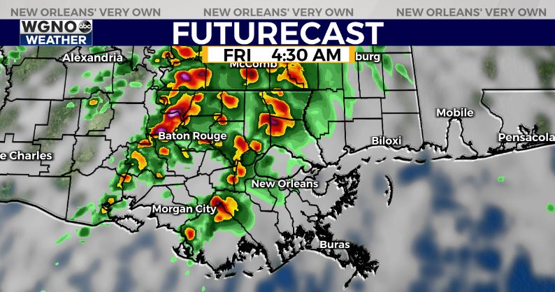
Another strong storm system will be pushing through the deep south later Thursday night and Friday morning. This will bring with it another chance for strong to severe storms.
Right now the Storm Prediction Center has us in a level 2 outlook threat for severe weather early Friday. It looks like we could see two waves of storms move through. The first one will be very early Friday as the warm front lifts north. This means warnings may be issued while you are sleeping so make sure you will be woken up if a severe storm is moving toward your area.

The second chance could come mid-morning as the cold front moves through. Strong wind gusts and tornadoes will be the main threats with this system although hail is also not out of the question.
Temperatures stay very mild behind the front with the upper 70s through the day. After that, we cool down into the weekend with upper 60s Saturday and low 70s Sunday. The weekend looks beautiful though with plenty of sun and no humidity.


