NEW ORLEANS (WGNO) — A few heavy downpours will slowly dissipate through tonight leaving us with warm and muggy conditions heading into Friday.
Another round of showers and storms will develop on Friday and provide some relief from the heat. Once again these could produce locally heavy rain due to them not moving much. Expect the same on Saturday with rain chances at 50-60% both days. Sunday looks drier and hotter with high temperatures back in the mid 90s.
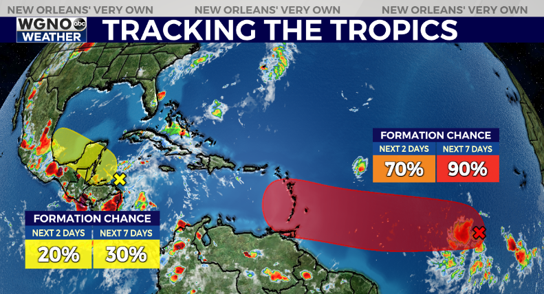
In the tropics, the main feature we are watching is currently labeled as Invest 95L. This a system still well out in the Atlantic southwest of the Cape Verde islands. Right now it has a 90% development chance through 7 days from the NHC.
It’s possible this could become our next named storm, and maybe even the first hurricane of the season. It will be fighting the Saharan Dust Layer which could inhibit development, although most models do indicate strengthening.

It is obviously very early and this system is still well to the east, but most models to agree on this moving west into the central Caribbean. At that point all options are still on the table for a most into Mexico or more into the Gulf.
This is not a concern for us at the moment, and very few system that originate in that area impact southeast Louisiana. However it is also something that we will keep a close eye on over the next week as it moves west.
As always be prepared now as we head toward the peak of hurricane season. Don’t wait until a storm is in the Gulf to get supplies or have a plan.
Stay up to date with the latest news, weather and sports by downloading the WGNO app on the Apple or Google Play stores and by subscribing to the WGNO newsletter.


