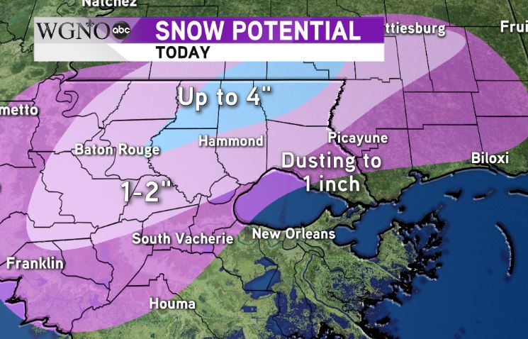
NEW ORLEANS – Snowfall continues Friday morning across the northern and western portions of the area.
Some of this snow is heavy at times.
Additional accumulations can be expected through midday, especially in areas where temperatures are closer to freezing.

Our latest thinking puts the heaviest TOTAL accumulations of up to four inches in extreme northern parts of our viewing area.
However, a large area of 1-2 inch totals can be expected across a larger portion of the area.
Areas to the southwest of metro New Orleans such as Houma and Thibodaux can also expect some light accumulations on grassy and elevated surfaces.
It’s important to remember that while a lot of the area is above freezing many areas along I-55 are right at 32 degrees. This will lead to slick spots on the roads that can cause dangerous driving conditions. This includes areas of Washington parish and through the River Parishes as well.
It’s a good idea to stay inside in these areas unless you have to get out and travel.

