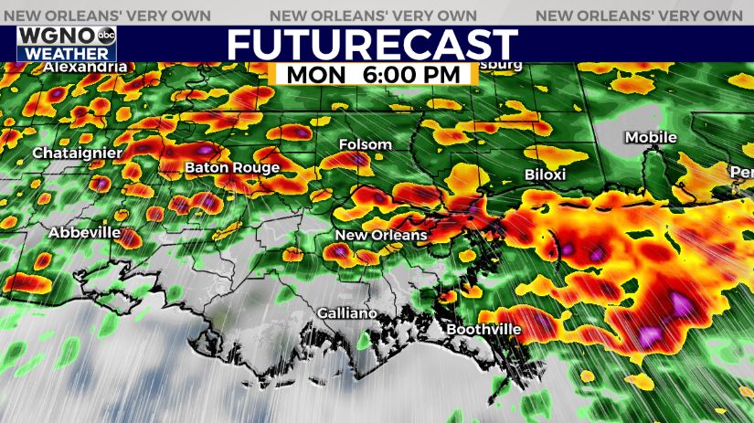
NEW ORLEANS (WGNO) — A very dynamic storm system is moving across the deep south Monday afternoon bringing several different threats across the area. Right now it looks like two main areas of concern in terms of severe weather. The first of those is moving through as the warm front lifts north through the early evening. Expect rain and gusty winds with storms capable of hail, damaging wind gusts, and isolated tornadoes.

The second threat comes in with the actual squall line tonight. That looks like the main threat with a better chance of isolated tornadoes and strong wind gust potential.

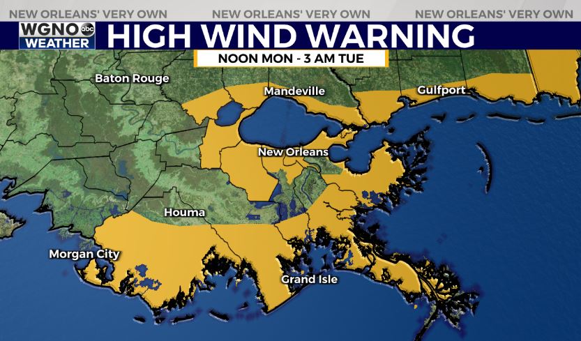
As always have a way to get warnings if one is issued for your area and make plans ahead of time to get in a safe place should a warning occur. The other factor through the day will be the very windy conditions. We will see gusts close to 50 ahead of this system out of the south. This means a high wind warning is in effect for the area until 3 AM.

We will still see windy conditions behind the front as well so a wind advisory is in effect through the day Tuesday with gusts continuing out of the north in the 30s. Coastal flooding will also be an issue through the night due to the strong onshore winds.
Stay up to date with the latest news, weather and sports by downloading the WGNO app on the Apple or Google Play stores and by subscribing to the WGNO newsletter.


