Good Morning, New Orleans! Another gorgeous start to today out there as temperatures are in the 50s or 60s! Yesterday was stunning, I hope you fully enjoyed it! Dewpoints remain in the 50s across the area which means very dry air and low humidity. This trend will stick around through at least Friday.
Expect a lot of sun over the next few days. Daytime highs will struggle to reach the low 80s. Overnight lows will range from the low to mid 50s north to low to mid 60s south.
The only issue today will be the high fire danger due to dry and breezy conditions. That coupled with low humidity and dry vegetation will create dangerous outdoor burning conditions. A wind advisory was in effect through last night but has now expired.
Temperatures begin to warm a little through the weekend, but it will still be beautiful.
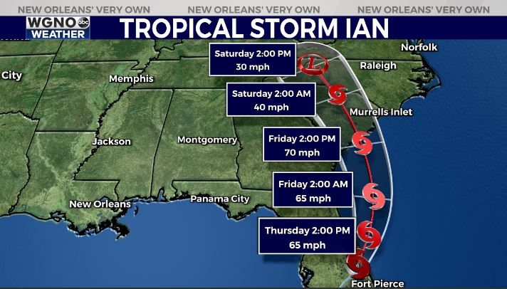
With Ian, now a tropical storm, tracking east of New Orleans, northerly winds on the left side of the storm will create breezy conditions Thursday.

Hurricane Ian made landfall near Fort Meyers, Florida Wednesday afternoon near Cayo Costa, Florida. Ian is now a tropical storm with 65 mile per hour winds as it moves towards the Atlantic. The system will loop northwest, making a second landfall near Charleston, South Carolina before progressing through the state. It will move towards North Carolina into our weekend.
We will continue to update the forecast for our southwest Florida neighbors all morning.
Our forecast for southeast Louisiana and the Mississippi Gulf Coast will be lovely.


