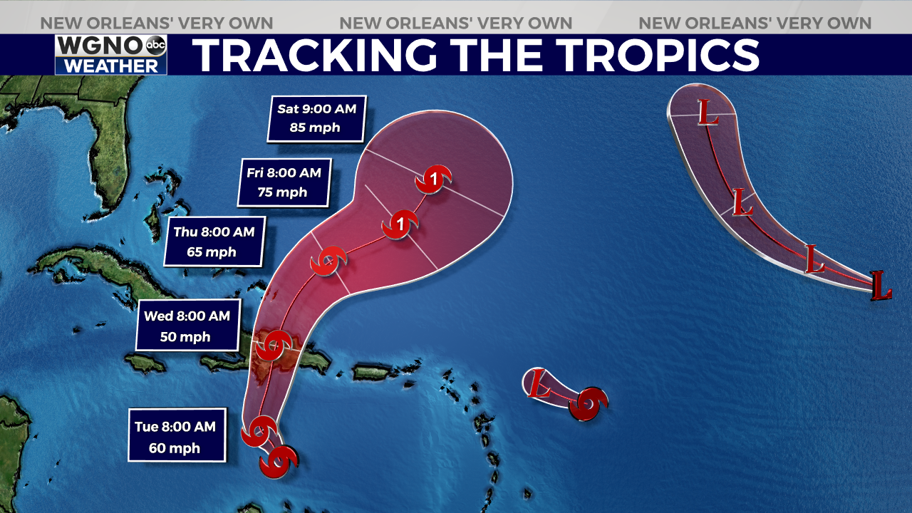
NEW ORLEANS (WGNO) — The National Hurricane Center is tracking five tropical disturbances in the Atlantic basin.
Advisories are being issued on four named storms in the Gulf of Mexico, Caribbean Sea, and Atlantic Ocean. An area of disturbed weather near Africa is also being closely watched for potential development later this week.
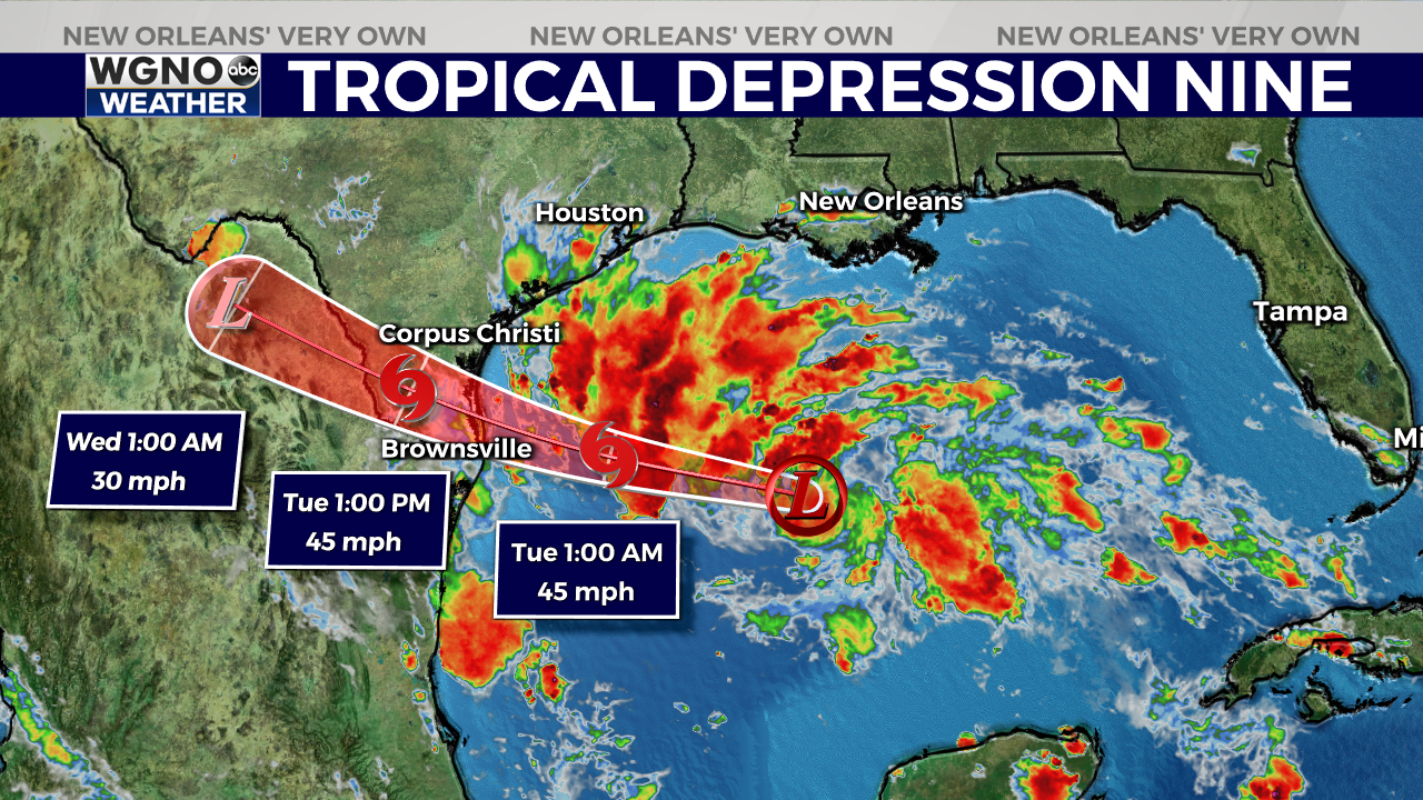
Tropical Depression Nine
On Monday, forecasters at the NHC issued tropical storm watches and warnings ahead of Tropical Depression Nine, which is currently located over the central Gulf of Mexico.
The system is forecast to strengthen into a tropical storm as it moves west over the next day or two. It is expected to impact portions of southern Texas and northeastern Mexico by Tuesday.

A Tropical Storm Warning is in effect for the mouth of the Rio Grande to Port O’Connor, Texas. A Tropical Storm Watch is in effect from Port O’Connor to Sargent, Texas.
Tropical Storm Franklin
Tropical Storm Franklin currently has maximum sustained winds at 50 mph and is located about 275 miles south of the Dominican Republic. Franklin is forecast to strengthen some before turning north by Tuesday.
The storm is expected to bring heavy rain to portions of the Caribbean over the next couple of days. About 2 to 4 inches of rainfall are expected across Puerto Rico, with isolated higher amounts of 6 inches possible. Some locations on the island of Hispaniola may receive 5 to 10 inches of rain, with isolated totals up to 15 inches.

A Tropical Storm Warning is in effect for:
- Dominican Republic – Entire south coast from the Haiti border eastward to Isla Saona
- Haiti – Entire south coast from Anse d’Hainault eastward to the Dominican Republic border
A Tropical Storm Watch is in effect for:
- Dominican Republic – Entire north and east coast from the Haiti border eastward and southward to Isla Saona
- Turks and Caicos Islands
Tropical Storm Gert
Tropical Storm Gert formed overnight about 400 miles east-southeast of the Northern Leeward Islands. It currently has maximum sustained winds near 40 mph.
On Monday afternoon, the National Hurricane Center said Gert is expected to become a post-remnant low and could dissipate “at any time.”
Post-Tropical Cyclone Emily
The NHC has issued its final advisory on Post-Tropical Cyclone Emily.
The storm is about 1,200 miles east of the Cabo Verde Islands with 40 mph winds and is forecast to remain at sea as it continues to gradually weaken.
Area of interest
The NHC is also monitoring an area of showers and thunderstorms associated with a tropical wave in the eastern Atlantic near the Cape Verde Islands. This system has a high chance, 70 percent, of becoming a tropical depression or tropical storm over the next seven days. It is expected to remain at sea.
Stay up to date with the latest news, weather and sports by downloading the WGNO app on the Apple or Google Play stores and by subscribing to the WGNO newsletter.


