All week, we have been closely watching one area of clouds and thunderstorms for potential development as a weak tropical depression or storm within the next 48 hours.
Right now, there is about a 90% chance for formation of this gradually materializing low pressure system by tonight to early Friday through your upcoming weekend. As a result of wind shear, the system will stay weak in intensity with much of the heaviest rain displaced well east of wherever its center forms and tracks onshore before moving inland.
More than likely, a low intensity tropical depression or storm will form and progress into the northern Gulf of Mexico for increased rain chances and a coastal flooding threat along Louisiana to Alabama Gulf Coast locations tomorrow until early next week. Anticipate an uped flood and heavy rainfall threat with totals between 4-10+ inches throughout much of southeast Louisiana and southern Mississippi, specifically New Orleans to Biloxi. Timing for Gulf Coast impacts will be between Friday and Sunday, possibly carrying into Monday.

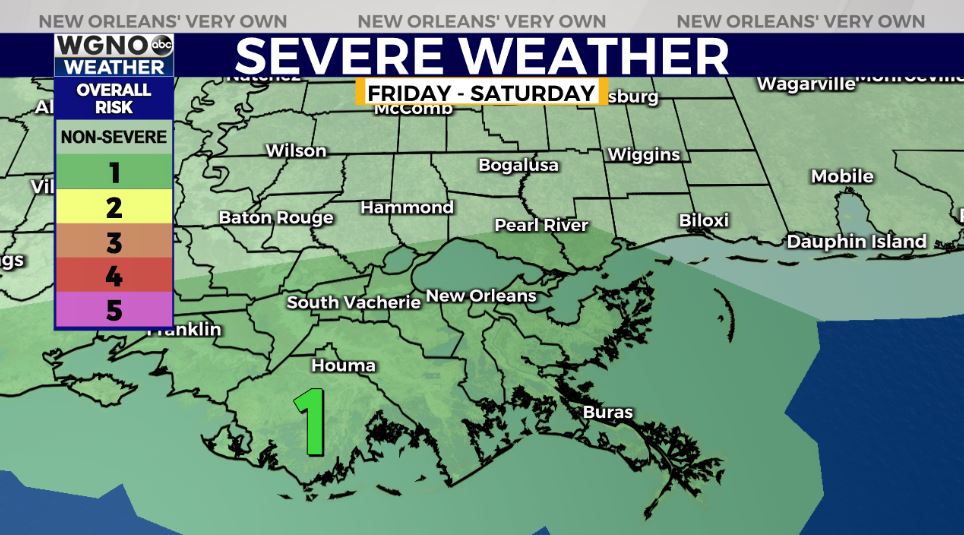
Right now, the Storm Prediction Center is issuing a Level 1/5 Marginal Risk for severe weather across southeast Louisiana tomorrow to Saturday given a low-end tornado threat as outer bands track northeast. Storm surge levels appear minimal between 2-4 feet, and wind gusts will likely range from 35-45 miles per hour, meaning power outages are a possibility.
The next name on the Hurricane Season 2021 naming list is Claudette because Tropical Storm Bill already came and went off of the East Coast. The next one on the list after this is Danny.
Stay with WGNO all week and weekend for forecast information on this developing system during our newscasts, online, and by dowloading the WGNO app.
Be intentional in reviewing your hurricane season preparedness plans and gathering necessary supplies as a precaution.


