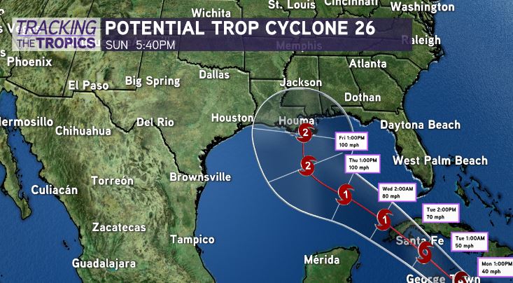
The National Hurricane Center is issuing advisories on Potential Tropical Cyclone 26, located in the Caribbean Sea just south of Jamaica.
It will likely be becoming named Delta over these next 24 hours. We are watching closely for forecast impacts along our Gulf Coast by late week. 5 days out, plenty questions remain, including track and strength, at that.

Caribbean and Gulf of Mexico environments do support intensification on tap by mid-week. Some models are quite bullish in intensity, but until Delta actually forms, exact direction and wind speeds are tough to pinpoint. Right now, the cone of uncertainty spans from west Louisiana to Florida’s panhandle.
As we have learned from Cristobal, Marco, Laura, and Sally, details will change between now and landfall, so you must pay attention to our forecast for the upcoming week. Right now, it’s still too early to specify direct impacts locally, but heavy rainfall late this week into next weekend looks highly likely at a minimum. Heaviest rainfall will be along and east of wherever this system tracks inland.
Good news? Water temperatures have cooled significantly over these last 3 weeks between Hurricane Sally’s upwelling and cold fronts impacting our forecast for New Orleans. This should help mitigate rapid intensification just ahead a landfall.
Water temperatures, nonetheless, support tropical development, but such cooler water should hinder rapid strengthening, possibly weakening any system that does organize. Gulf water temperatures do, however, remain warm enough for formation potential to be a concern.
Until then, the weather across New Orleans will be beautiful. Anticipate a gorgeous night tonight and day tomorrow as temperatures remain pleasant with low humidity. Stay tuned!


