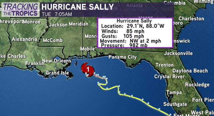
TURN HAPPENING — 7AM Advisory now has Sally moving Northwest at 2mph. At 1AM it was W at 3, 4AM it was WNW at 2, and now NW at 2mph.
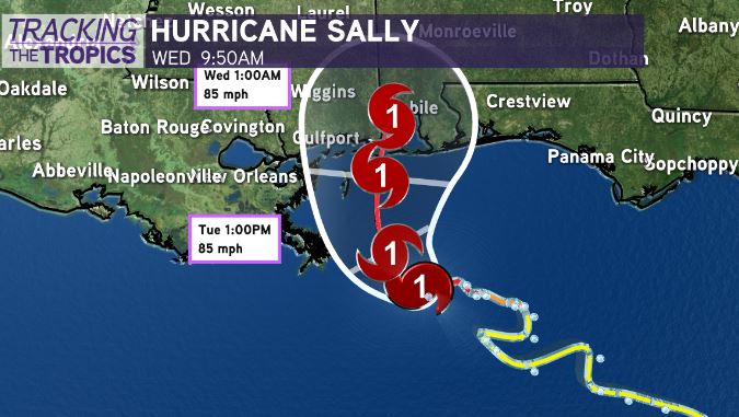
Latest update on #Sally has max winds of 85mph, Category 1 Hurricane. WNW at 2mph. System stalling & beginning slow crawl northward. Landfall now expected mid-morning-late afternoon Wednesday near MS/AL state line.

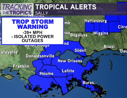
HURRICANE WARNING DROPPED for New Orleans Metro — Replaced with Tropical Storm Warning. FLASH FLOOD WATCH cancelled for all of Southeast Louisiana.

Residents in extreme southeast Mississippi/south Alabama, and the Florida Panhandle should batten down the hatches for likely hurricane strike late tonight-tomorrow afternoon.

This is a situation where “It’s just a Category 1” is not an accurate depiction of the impacts that will be felt. Slow-moving #Sally will bring flash flooding, longer duration wind impacts, & significant storm surge.

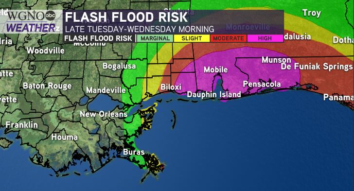
Historic rainfall possible in south Alabama/Florida Panhandle. Weather Prediction Center showing 12-20+” of rainfall possible. National Weather Service in Mobile mentioning some spots could receive isolated 30″ of rain from #Sally.
Trend continues to be your friend in Southeast Louisiana — Overnight model guidance continues its pivot east. This trend would drastically reduce wind/rain impacts for inland southeast Louisiana. Winds 35-50mph in New Orleans Metro on current path. That’s minimal. Isolated power outage.
Rainfall would also be minimal at .5-1.5” maximum. We see more than that with a summertime thunderstorm. Coastal flooding still a big-time concern of 6-9 feet from Mouth of MS River to MS coast.


