—
7:30 PM
Convection is quickly redeveloping around the center of Zeta this evening. If this trend continues overnight we could be looking at a strong category one storm by tomorrow. The next 12 hours will be critical to see how much this can redevelop.
—
4:30 PM
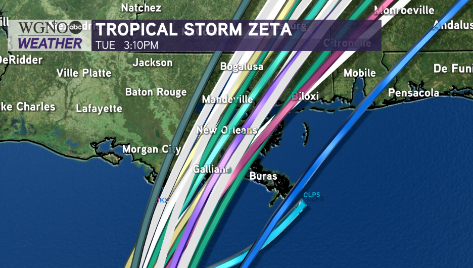
Based off of the National Hurricane Center’s 4PM advisory, Tropical Storm Zeta has 65 mile per hour winds but is moving at 14 miles an hour. It has also shifted back west, looking to put our New Orleans metro in the direct line of its track. This is of concern as the greatest impacts will be along and east of wherever Zeta’s center comes ashore.

It will continue progressing into the Gulf of Mexico today, impacting our forecast for New Orleans and southeast Louisiana Wednesday. Landfall near Terrebone Parish, Louisiana still looks likely Wednesday night.

Wednesday evening through early Thursday morning, Hurricane Zeta will be beginning to move inland in Louisiana. Tomorrow afternoon after lunch until Thursday morning will require “sheltering in place” for southeast Louisiana & south Mississippi. Prepare as widespread power outages and a number of downed trees are area-wide possibilities.
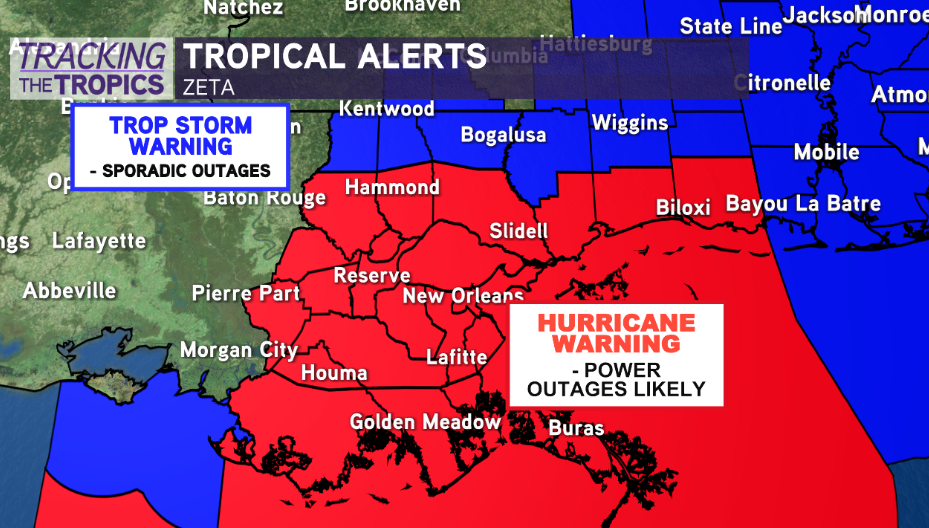
Hurricane Warnings remain in effect throughout our Greater New Orleans area, spanning the coastline from Morgan City, Louisiana to the Mississippi, Alabama border.

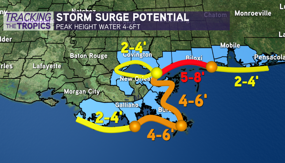
Grand Isle, Louisiana will likely see between 4-6 feet of surge, while Lake Ponchartrain will likely see between 2-4 feet of surge. This is something the levee system can handle. The Mississippi Coast, including Bay Saint Louis and Pass Christian will see greatest surge amounts, anywhere between 5-8 feet.

A Storm Surge Watch is in effect from Intracoastal City, Louisiana, to Navarre, Florida, including Lake Borgne, Lake Pontchartrain, Vermilion Bay, Pensacola Bay, and Mobile Bay.
Tropical Storm force winds are area-wide concerns given Zeta’s current track. Anticipate an uptick in power outages while this is moving through late Wednesday, early Thursday.
Thankfully, with Zeta’s fast moving nature, rainfall totals will be between 3-6 inches in most neighborhoods, but localized higher amounts will be possible. As always, flash flooding could occur if any heavy bands dump large amounts in little time. The main issue is Turbine 4 being down at the Carrollton Pump Station, which may impact drainage pump efficiency.
#Zeta should move quickly, and most substantial wind impacts will only last 4-6 hours total. Winds will quickly ramp up from 3PM-6PM across the area, with the system out of our area by 1AM. Make sure you have all of your preparations finished before noon Wednesday, as conditions will quickly deteriorate tomorrow afternoon through evening. Be aware, even after the storm is passed, power lines and trees could be knocked down. Staying put until the sun comes up Thursday morning will likely be best.
Check out current conditions near you: https://digital-staging.wgno.com/weather/new-orleans-weather-radar/
Stay up to date with the latest forecast: digital-staging.wgno.com/weather/forecast/
Download the WGNO Weather App to stay connected this hurricane season


