NEW ORLEANS (WGNO) — Tropical Storm Alberto has become the first named storm of the 2024 Atlantic hurricane season, which is expected to be above normal due to anticipated La Niña conditions and warm sea surface temperatures.
Formation and Current Status
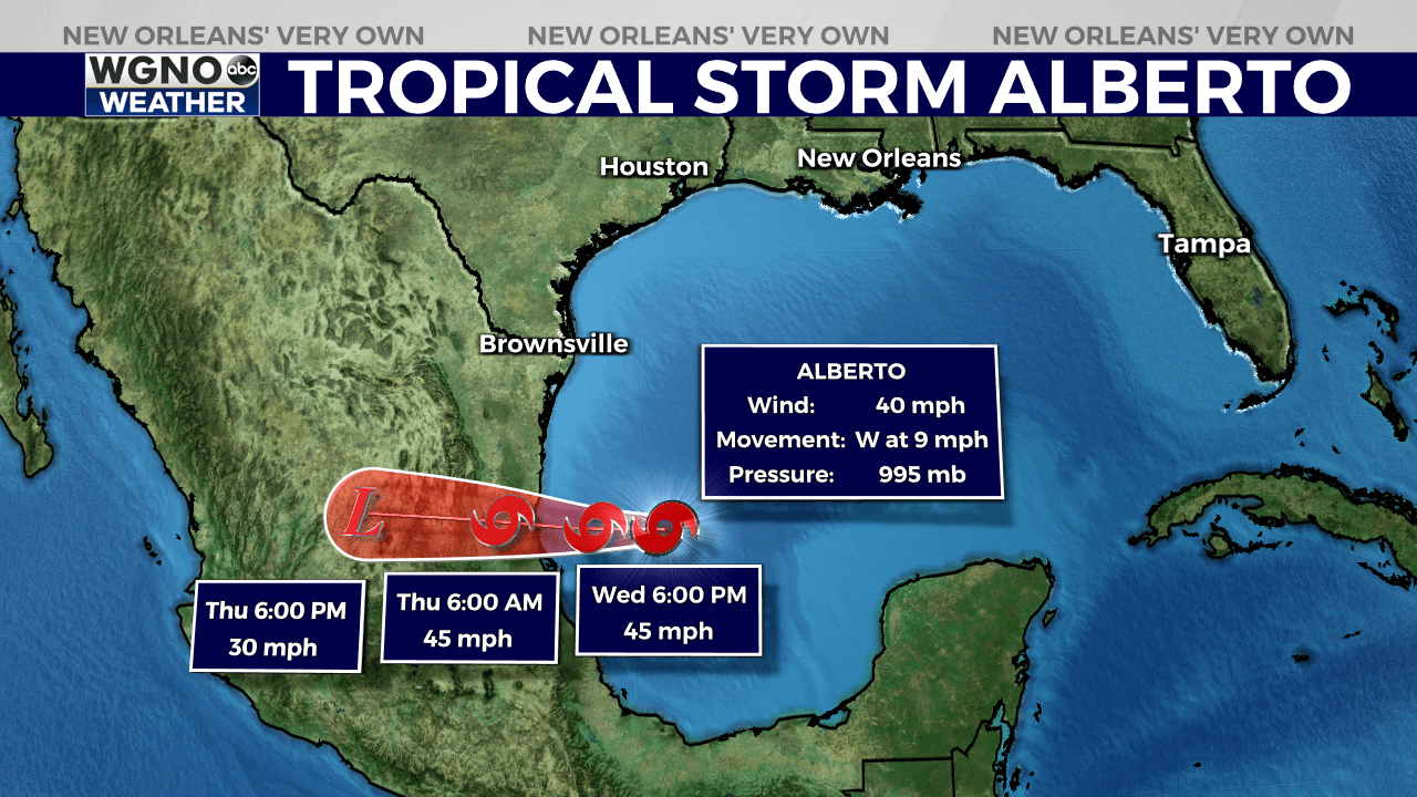
An U.S. Air Force Reserve reconnaissance aircraft and a NOAA buoy confirmed Alberto’s well-defined center of circulation and increasing storm activity near the center, leading to its classification as a tropical storm. Alberto currently has sustained winds of 40 mph and a central pressure of 995 millibars.

Projected Path and Strength
Alberto is moving westward at 9 mph and is expected to continue this path, reaching northeastern Mexico by Thursday morning. The storm may strengthen slightly, with a peak intensity of around 45 mph before landfall. Rapid weakening is forecast after landfall, with the storm likely dissipating over Mexico’s mountainous terrain by Friday.
Potential Impacts
Regardless of its exact track, Alberto is expected to bring heavy rainfall, moderate coastal flooding and tropical-storm-force winds to areas far from its center. Tropical storm conditions are expected today along portions of the Texas coast south of San Luis Pass and along parts of northeastern Mexico within the Tropical Storm Warning area.
Heavy rainfall is anticipated to affect large regions of Central America, northeastern Mexico, and South Texas. For Louisiana and Mississippi, isolated to scattered heavy downpours are possible as Alberto’s outer bands move across the region. Any storms that develop are expected to be brief.

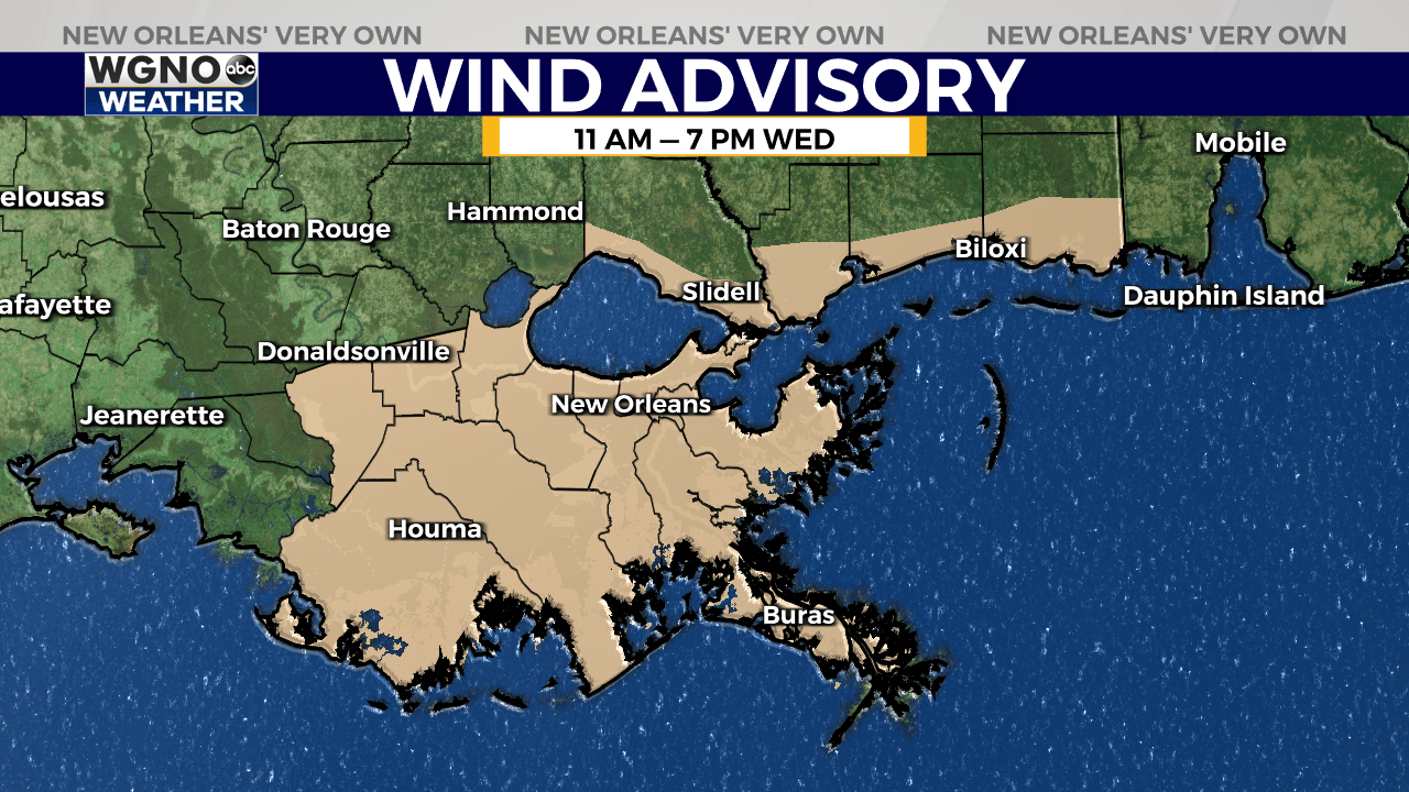
A Wind Advisory is in effect for southeast Louisiana, including areas south of the I-12 corridor, near area tidal lakes and along the coast.
Expect strong east winds of 20 to 25 mph, with gusts up to 40 mph possible, from 11 a.m. to 7 p.m. Wednesday. The National Weather Service recommends securing any loose items and reminds residents to be cautious when travelling, especially in high profile vehicles.

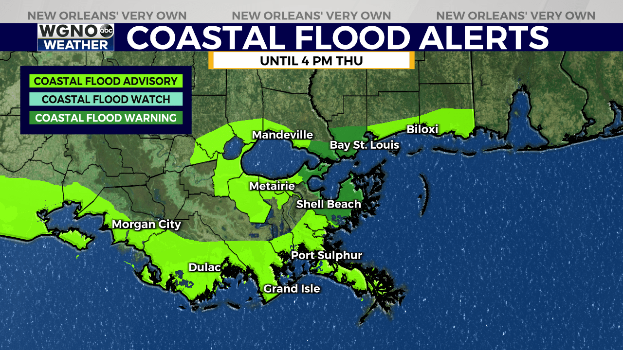
Moderate coastal flooding is likely along much of the coasts of Mississippi, Louisiana, Texas, and Mexico through Thursday. For the northern Gulf Coast from Pascagoula, Mississippi to Morgan City, Louisiana, 2 to 4 feet of coastal inundation will be possible during high tide cycles.
Stay up to date with the latest news, weather and sports by downloading the WGNO app on the Apple or Google Play stores and by subscribing to the WGNO newsletter.


