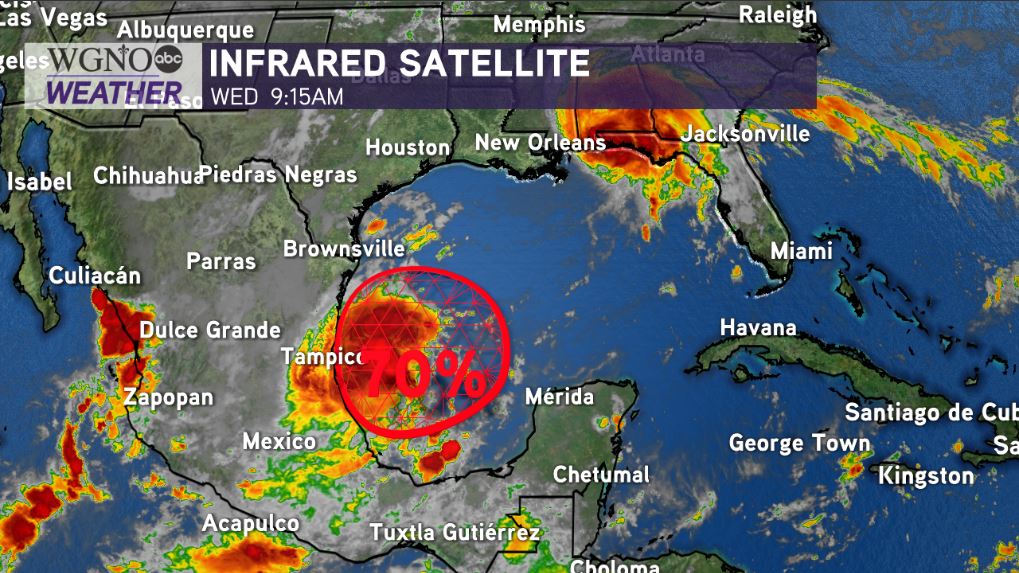
A tropical disturbance in the southwest Gulf of Mexico now has much higher chances for formation and development within the next 3-5 days and will be worth closely watching.
National Hurricane Center meteorologists are continually eyeing a low pressure system producing disorganized storms, thunderstorms, and showers just off of Mexico’s coastline.
The National Hurricane Center is now giving the area a 70% chance of development over these next 3-5 days as the system stalls and meanders in the southwest Gulf of Mexico.
Generally, model guidance shows this is likely to remain in the Bay of Campeche and southern Gulf, staying trapped before moving toward southern Texas. Stout high pressure with lovely weather in Louisiana will keep this disturbance trapped in the South Gulf for at least the next 3 days. Some models do move this system inland, with little to no issues.
There is the outside chance, however, this disturbance tries to be a little wonky by late into our upcoming weekend through early next week and tries moving northward. The longer the system sits in the Gulf of Mexico, the better the odds are it could get pulled northward down the road.
Certainly, any disturbance near the Gulf of Mexico is worth closely monitoring during peak hurricane season in September.

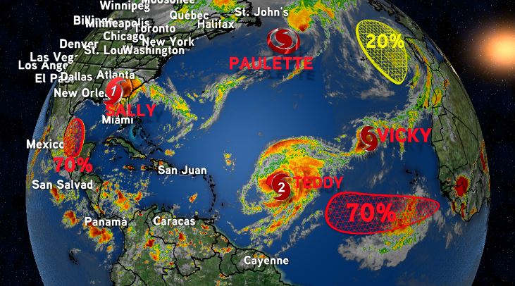
There is only one name left on the 2020 Atlantic Names list before the Greek alphabet—used last during the 2005 hurricane season, which spurred Katrina.
Monday marked the first time five named storms were in the Atlantic Basin at once in 49 years. The National Hurricane Center has not issued advisories on this many named storms at a time since 1971. Paulette, Rene, Sally, Teddy, and Vicky set a record for most named storms at once in the Atlantic Basin, not to mention additional spots worth monitoring for formation potential.
Right now, no other areas are of concern locally as Hurricane Sally’s damage assessments along the Gulf Coast are only just beginning. Pay attention to forecasts for the upcoming week. We are going to continue watching it all very closely.


