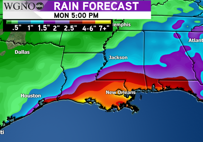
The likelihood of a tropical system is still high in the northern Gulf of Mexico through the rest of the week. A broad area of low pressure is moving off the coast of Florida Tuesday afternoon into an area of favorable development.
There are still several questions regarding the intensity of this system and where it will go, although models have come in to better agreement on a Louisiana landfall.
A system that moves inland in south central Louisiana would have less time to strengthen over the warm waters of the Gulf. However a disorganized system also tends to produce a larger area of heavy rain due to the lack of a tight circulation around the center.
As it stands right now rain looks to be the biggest impact to the area.  Heaviest rain totals looks to be across south central and southeast Louisiana with more than 7 inches possible. Higher amounts in some forecast models are well over 15″. A secondary threat with a landfall to the west would be the potential for isolated tornadoes, depending on how strong the circulation is with the storm.
Overall Thursday through Saturday look wet with the potential for rain flooding issues. Still too early to tell all the details with this system but somebody will likely get large rain totals.
A slow moving system could also cause more coastal flooding concerns with a longer duration of wind moving onshore.
Continue to stay alert to the weather conditions through the week and as always follow WGNO on air and online for the latest.


