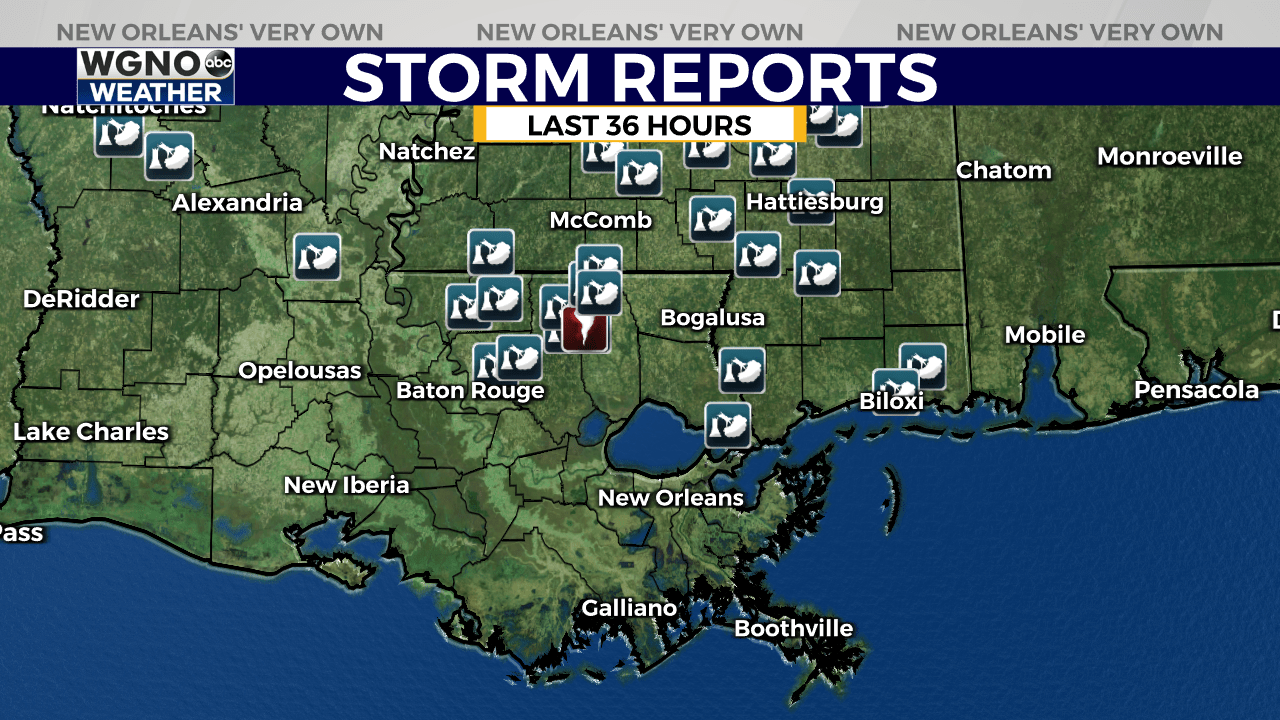
KENTWOOD, La. (WGNO) — The National Weather Service has confirmed that two tornadoes touched down across southeast Louisiana and South Mississippi on Tuesday, June 4.
Additional information with greater details will be added over the next few days after survey crews double check data. Additional surveys may be needed as information comes forward.
Here’s what we know from the National Weather Service Report:

There was widespread tree damage across multiple parishes and counties but more focused damage and possible tornado paths occurred across Amite and Pike Counties in Mississippi, and St. Helena and Tangipahoa parishes in Louisiana.

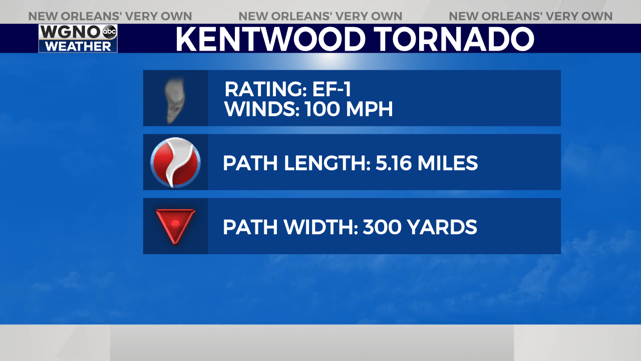
The strongest tornado of the afternoon was an EF-1 tornado that touched down just east of Kentwood north of Highway 38 where a snapped pine tree was observed.
The tornado continued over mostly open fields until Highway 1054 where it uprooted and snapped numerous trees. It then continued east to W. Lewiston Road where the most impressive tree damage was observed.

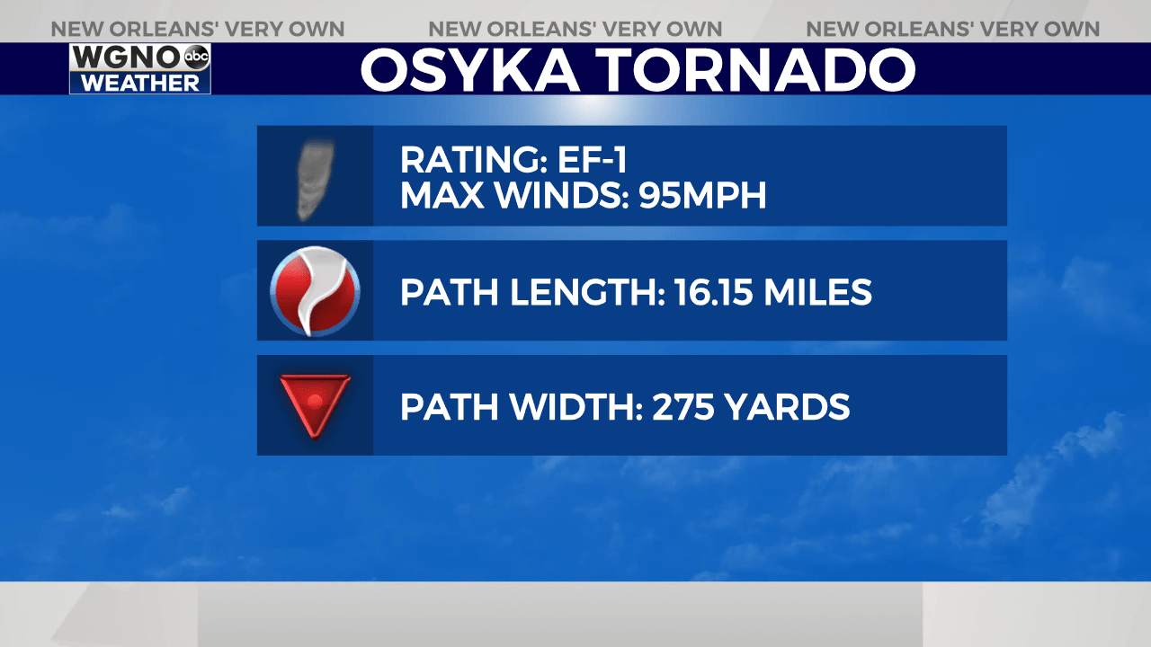
An additional EF-1 tornado was confirmed along the Louisiana-Mississippi state line from Gillsburg to Osyka. Snapping numerous trees over a 16 mile path.

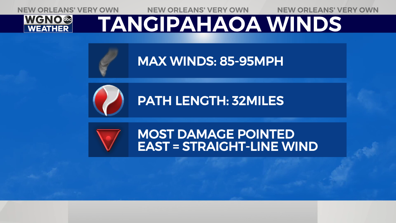
Lastly, it was confirmed that 85-95mph straight-line winds caused sizeable damage near I-55 in Amite to Husser along a 32 mile path. The direction of nearly all of the damage was facing east indicating that straight-line winds were likely the cause of damage rather than a tornado, which typically has more chaotic damage tossed in multiple directions.
Additional information with greater details will be added over the next few days after survey crews double check data. Additional surveys may be needed as information comes forward.
Stay up to date with the latest news, weather and sports by downloading the WGNO app on the Apple or Google Play stores and by subscribing to the WGNO newsletter.


