![]() JUST IN
JUST IN![]() — Hurricane Delta remains a large, powerful Category 3 hurricane with max winds of 120mph. Finish last minute preparations along the southwest Louisiana coast, as conditions will begin deteriorating later this morning.
— Hurricane Delta remains a large, powerful Category 3 hurricane with max winds of 120mph. Finish last minute preparations along the southwest Louisiana coast, as conditions will begin deteriorating later this morning.
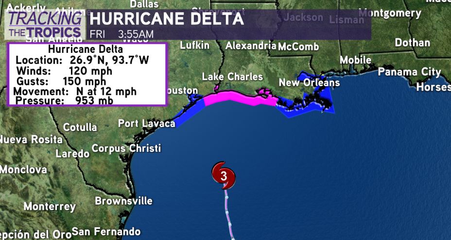
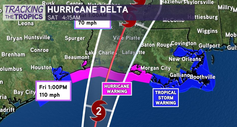
No major track changes with slight shift east with landfall expected along eastern Cameron Parish/Vermilion Parish this evening as a Category 2. Could it still trend slightly east or west by ~20-30 miles? Yes, we will watch wobbles. But, drastic shifts not expected.
Huge wind field with Hurricane #Delta. Hurricane force winds extend 40 miles from the center while tropical storm force winds extend outward over 160 miles from the center.
Remember, just because the system’s center may not impact you doesn’t mean you won’t see impacts well east of where its center comes onshore.
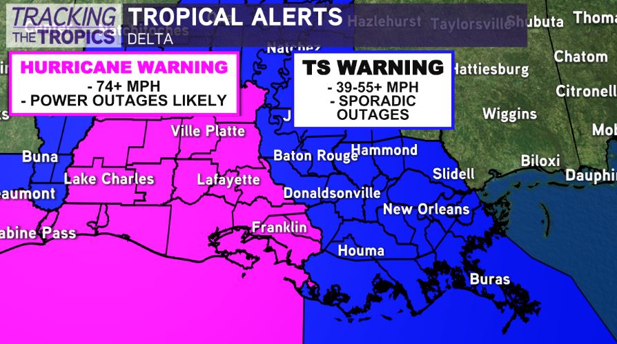
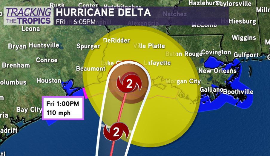
Delta’s greatest impacts will stay to our west in Acadiana and southwest Louisiana. Hurricane conditions likely from Lake Charles to Lafayette. 75-90mph gusts & power outages likely likely. Power outages likely in Acadiana/southwest Louisiana from Breaux Bridge to Lake Charles.
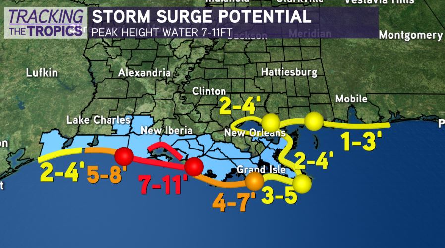
7-11ft of storm surge from Rockefeller Refuge to Vermilion Bay.
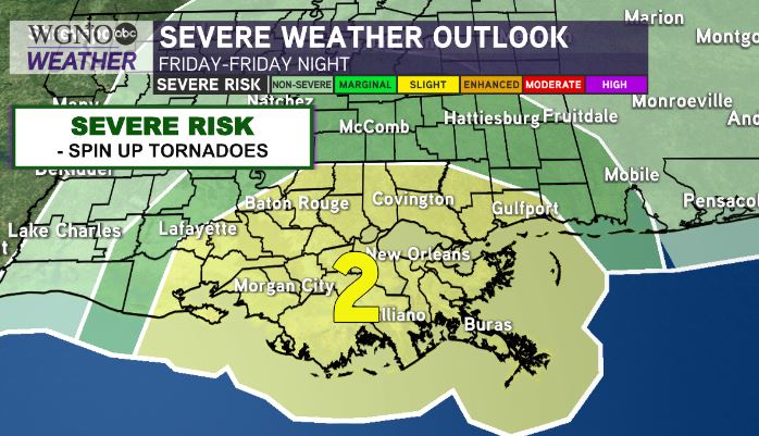
In southeast Louisiana, we are still expecting impacts. Main risks in southeast Louisiana & New Orleans Metro: tornado threat late Friday-overnight Friday, 25-50+mph wind gusts, 1-3” of rainfall. We will monitor for localized higher amounts.
Tropical storm force gusts are still likely on the projected path all the way to Metro New Orleans. Sporadic power outages are a possibility, mainly in the Bayou/River Parishes towards Baton Rouge.


