10:30 PM
Rain in the area has finally ended, meaning conditions will be beginning to improve overnight. At that point, temperatures range from lower – upper 60s across Northshore and Southshore locations, respectively. Fog does not look super dense tomorrow morning like we were experiencing just 18 hours ago.
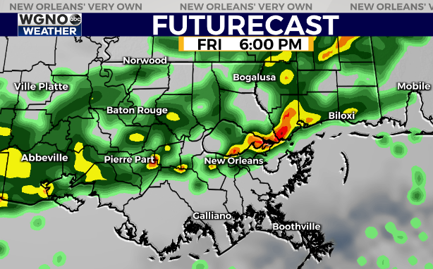
Tomorrow remains mostly cloudy with intermittent showers before severe weather likely returns given our forecast for Sunday morning. Have ways you can receive warning information on hand incase of spin up tornadoes. We cannot totally rule out localized street flooding as a heavy rainfall threat materializes.
—
6:30 PM
Heavy rain in many portions of the viewing area will continue tonight to end by midnight. Gusty winds are a main severe threat within strong thunderstorms… Have ways for receiving warning information on hand.
Overnight, temperatures stay warm ranging from upper – lower 60s across Northshore and Southshore locations with your high forecast nearing 70 by Saturday afternoon after lunch. Expect more showers, but Sunday morning’s storms could spawn tornadoes, so this is our main event ahead before cold air returns!
—
10:30 AM
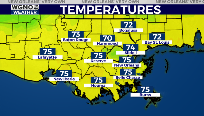
Temperatures are warming quickly this morning with a spring-like feel around the area. We are already seeing low to mid 70s.

Expect a mild afternoon with showers and storms developing on the north shore first through the Florida parishes and then moving south by this evening.

Some of those storms could produce locally heavy rain and gusty winds. We are still looking at widespread heavy rain and a severe weather threat Sunday morning before things clear out.
—
7:30 AM
More rain is on the way through the rest of the holiday weekend before a preview of winter moves in. Look for showers and storms across the Florida parishes this afternoon and evening with some of that activity spreading south overnight.
There is a slight chance of a stronger thunderstorm this afternoon but right now that looks small. Otherwise we will see mid to upper 70s this afternoon.
Another big storm system moves across the area early Sunday. This one does have the chance of severe weather with it especially on the south shore. The track of the low will be key to determine exactly where the strongest weather is. Have a way to get warnings though early in the morning when you may need to be woken up.
After that a big time surge of early winter air comes in by late Sunday and early next week. We could see our first freeze of the season in the colder spots by Tuesday morning. Highs will only top out in the 50s.
Check out current conditions near you: https://digital-staging.wgno.com/weather/new-orleans-weather-radar/
Stay up to date with the latest forecast: digital-staging.wgno.com/weather/forecast/
Download the WGNO Weather App to stay connected this hurricane season


