New Orleans’ forecast for Thursday night includes limited shower activity. Today we were dealing with above normal, Spring-like temperatures, but Winter comes back to town by tomorrow morning.
On radar, expect our storm threat at or before midnight. Right now, no severe elements are area-wide concerns.
Conditions improve once this system progresses east, then the much colder air filters through behind front number two of your week.
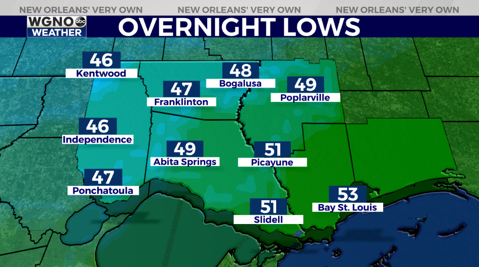
Anticipate a chilly start with 40-50 degree temperatures beyond Lake Pontchartrain.

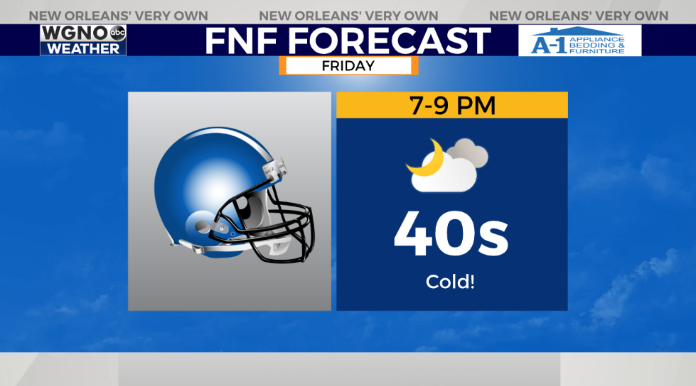
Highs by everyone’s afternoon after lunch should reach just below 60! Bring those blankets if attending high school football games once conditions will be becoming frigid after a while outside.
Keep up, updates stay available during WGNO’s 10:00 P.M. newscast plus online on WGNO.com!
Check out current conditions near you: https://digital-staging.wgno.com/weather/new-orleans-weather-radar/
Stay up to date with the latest forecast: digital-staging.wgno.com/weather/forecast/
Download the WGNO Weather App to stay connected this hurricane season